nw coast
from Bosa to Costa Paradiso
Beaches
If you want to continue the navigation, please sign up
Request your temporary Access Code
This operational platform has been created to help yacht captains, yacht brokers, crew members, yacht agents and all people involved in the yachting industry to find in our DISCOVER SARDINIA section the right operational tool for cruising Sardinia. Nautica Assistance reserves the right to accept or decline the registration. Once accepted you will be receiving an access code with a validity of six months.
-
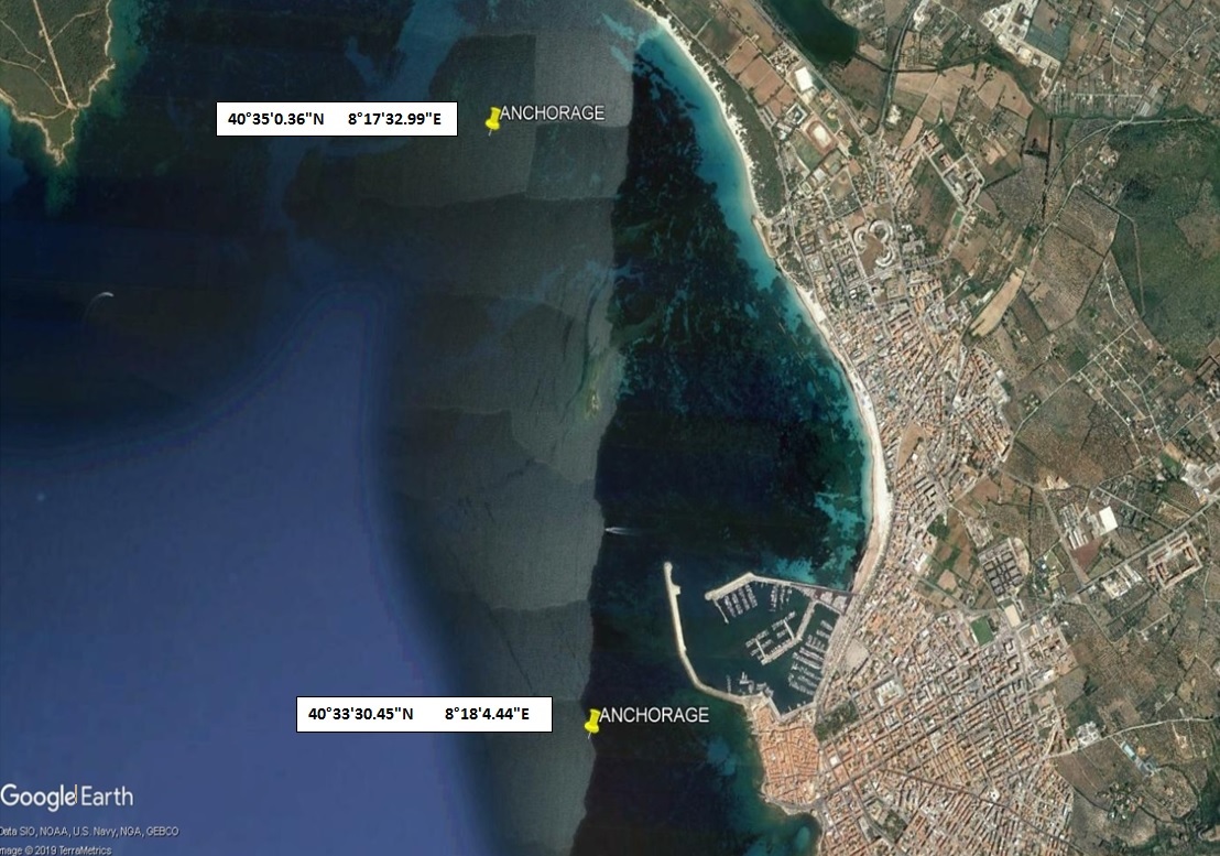
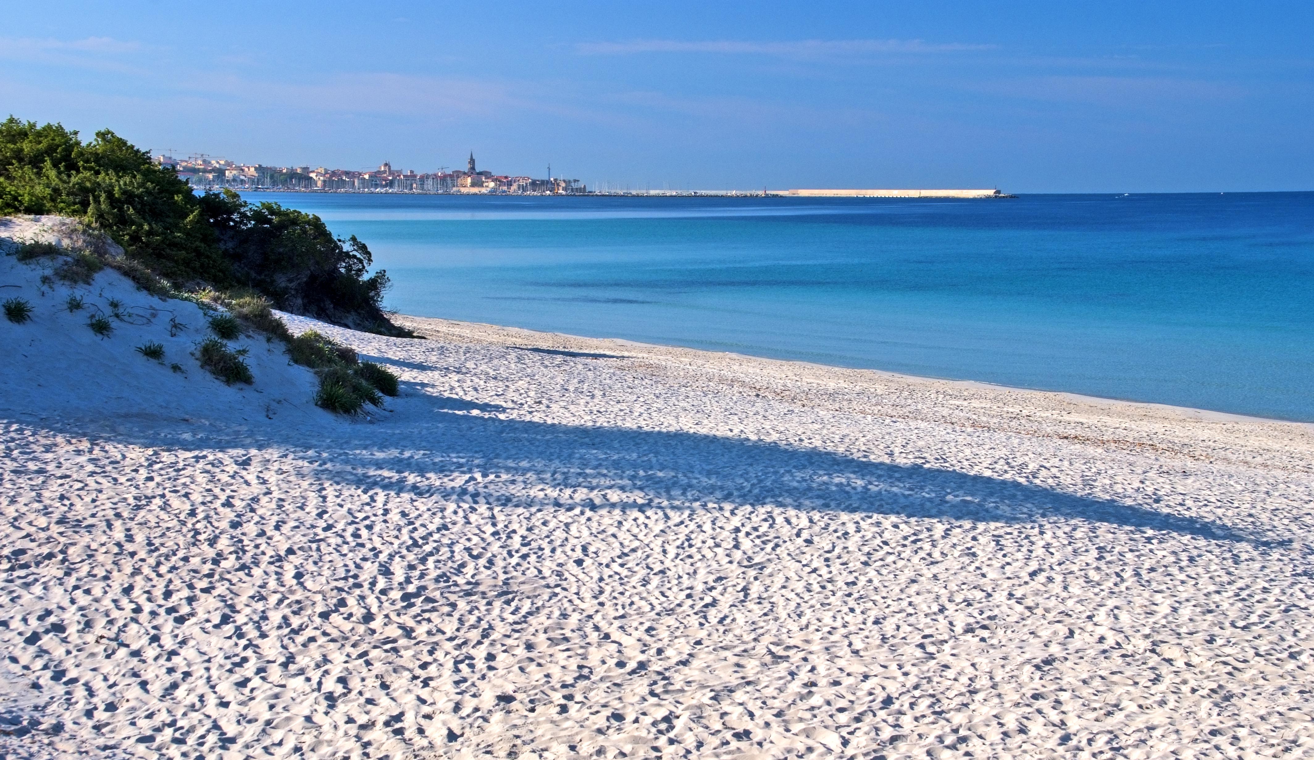
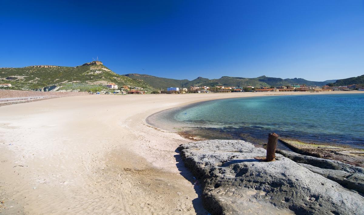
ALGHERO AREA - Alghero bay
×
ALGHERO AREA - Alghero bay
-
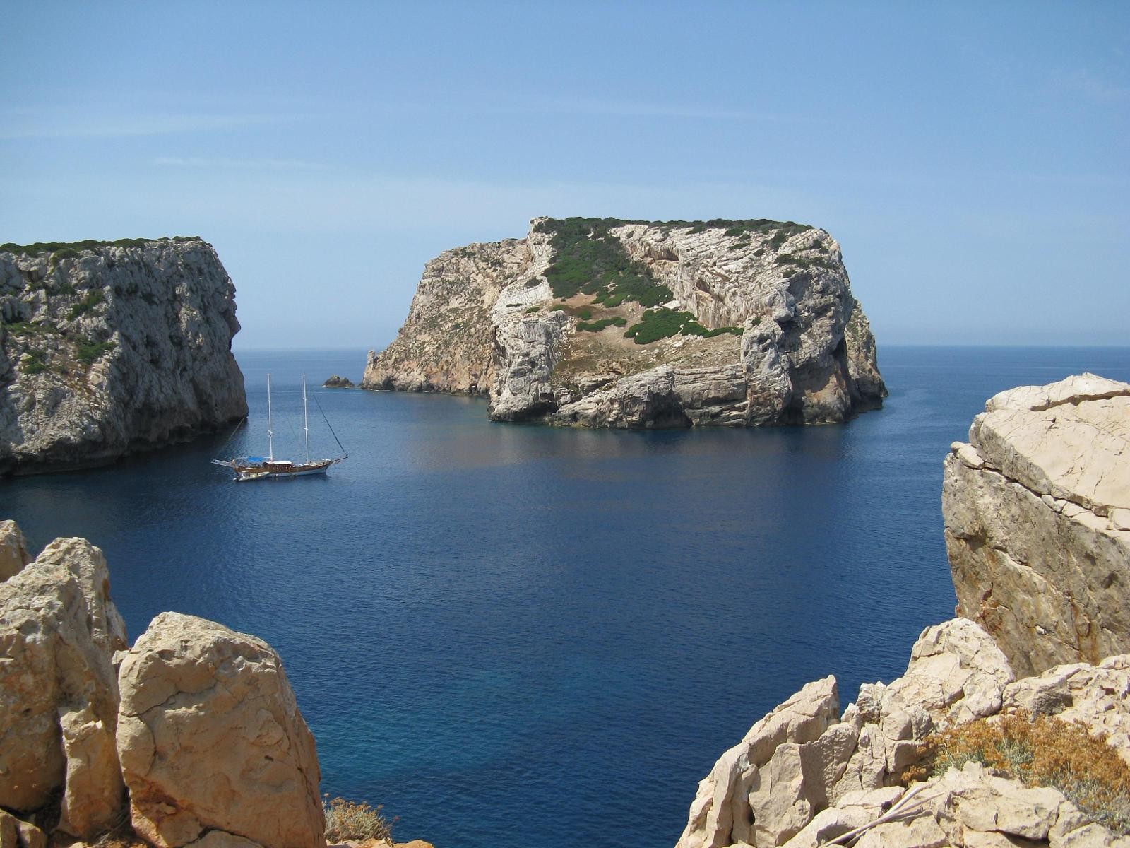
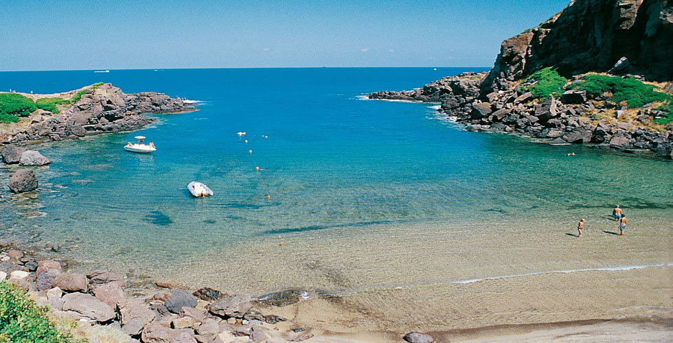
ALGHERO AREA - Punta Giglio
×
ALGHERO AREA - Punta Giglio
Coordinates: 40°34'06.0"N 8°12'15.8"E
It is a small beach hidden among the pines of Punta Giglio, get there after a long walk, the water is wonderful, the pristine beach and plenty of fish. The Mediterranean brush is present in its various evolutionary and climatic stages, from the low, degraded brush to the more evolved holm oak and strawberry tree
-
ISOLA ROSSA AREA - Pedraladda
×
ISOLA ROSSA AREA - Pedraladda
-
ISOLA ROSSA AREA - Cala Canneddi
×
ISOLA ROSSA AREA - Cala Canneddi
Coordinates: 41°01'35.0"N 8°53'33.5"E
Cala Canneddi is located on the Isola Rossa (Red Island).The sand is spotless and more-or less fine-grained and has multicoloured pebbles at the water’s edge, a number of different sized and shaped rocks and several imposing extremely beautiful dark pink masses at its end.
On the Li Canneddi Headland, before the Tinnari Coast, the beach of Cala Rossa is found in a magnificent natural environment, among bright sand, pink-coloured rocks, characterised by the presence of quartz crystals, and last but not least. the deep-blue sea and the green of the vegetation around the shore. -
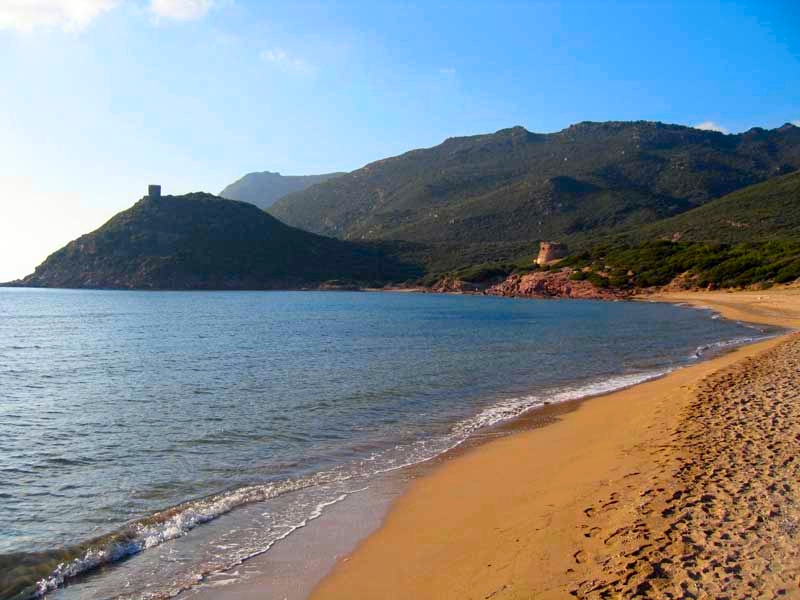
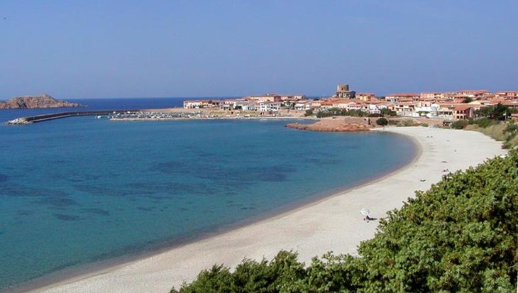
BOSA AREA - Marina di Bosa
×
BOSA AREA - Marina di Bosa
Coordinates: 40°17'19.0"N, 8°28'44.2"E
The large beach of Bosa Marina offers a particularly fascinating spectacle if you observe it from the majestic tower that dominates the landscape and which is located on top of a hill at the mouth of the Temo river. The beach, easily reachable by car or by bike, is characterized by its dark sand. -
ALGHERO AREA - Maria Pia
×
ALGHERO AREA - Maria Pia
Coordinates: 40°35'03.4"N 8°18'28.4"E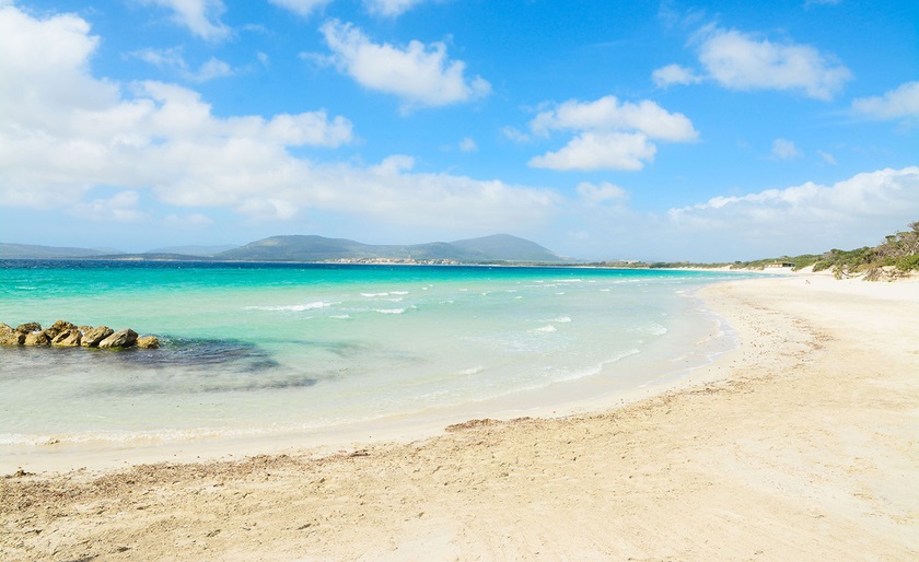
Pine forest beach towards Fertilia. Famous for its clean and warm water. White sandy dunes, centuries old junipers sculpted by winds and various kinds of plants typical of the Mediterranean scrub dot the scenery of this beach. The shallow water and sandy bottom, as well as the possibility of finding shade in the Maria Pia pine forest make it a nice place for spending an entire day of relaxation, in a valuable oasis of green. Just a few hundred metres from the city, along the coastal road linking Alghero to the town of Fertilia. -
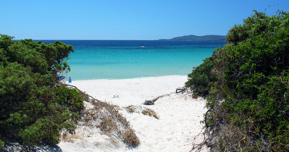
ALGHERO AREA - Le Bombarde
×
ALGHERO AREA - Le Bombarde
Coordinates: 40°35'03.9"N 8°15'28.4"E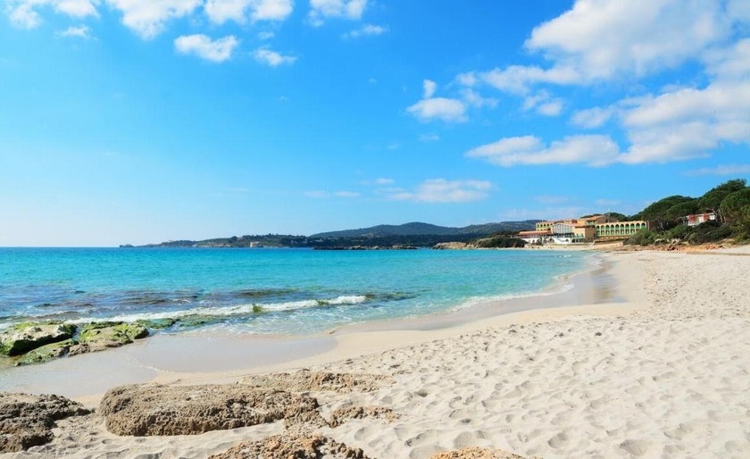
Le Bombarde Beach is a small bay between the rocks. Less than 1 km long, the beach is a few dozen metres wide. It slopes towards the water, which deepens just a few metres from shore. The water is almost always calm, crystal-clear, and always quite cold. There is a sandy bottom with numerous rocks emerging, especially at the two ends. The sand is fine and very white. Extremely popular among young people who tend to congregate near the bar, making the beach more "livable" towards the sides. Behind the beach there is a dense pine and eucalyptus woods. -
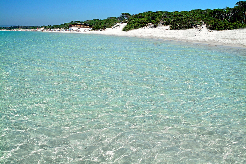
ALGHERO AREA - Mugoni Beach
×
ALGHERO AREA - Mugoni Beach
Coordinates: 40°37'03.9"N 8°12'08.8"E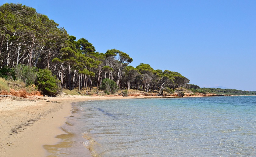
White sand beach and clear water with a beautiful natural setting. Protected by very dense eucalyptus trees, Mugoni Beach is quite narrow but several kilometres long. With very fine white sand, the water is always cool, even in August, and being a bay, it is usually sheltered from currents and winds. The water is crystal-clear with a sandy bottom. -
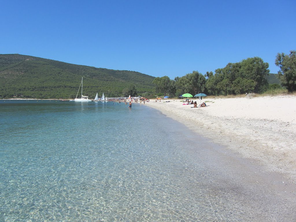
ALGHERO AREA - Tramariglio
×
ALGHERO AREA - Tramariglio
Coordinates: 40°35'23.4"N 8°10'09.7"E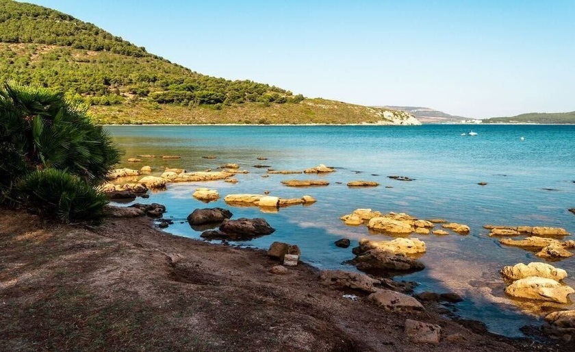
From the greens of the Mediterranean vegetation stands out a seventeenth-century tower overlooking the small bay of Tramariglio. Just a few minutes from the imposing cliffs of Capo Caccia is a small equipped tourists' port and a small and tranquil golden sand and pebble beach. Behind the beach lies a forest, host to a splendid oasis of replanted fauna called the “Le Prigionette' (The Small Prisons).
-
ALGHERO AREA - Cala Dragunara
×
ALGHERO AREA - Cala Dragunara
Coordinates: 40°34'33.150"N 8°9'39.499"E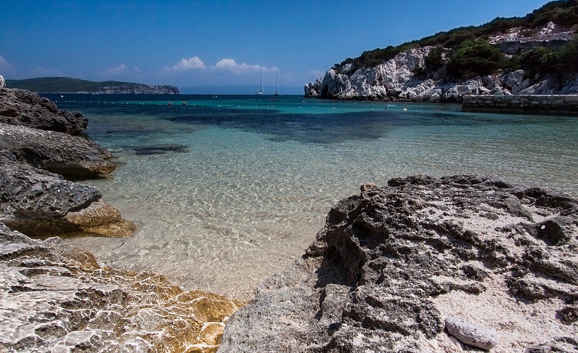
At the foot of the Capo Caccia cliffs, nestled in Mediterranean scrub, lies Cala Dragunara (Dragunara Cove). Close to the cove can be found the Grotta della Medusa (Medusa's Grotto), in which Neolithic artifacts have been discovered, and the Inghiotitoio di Dragunara (Dragunara Ponor). From the Cala Dragunara – above which stands the Bollo tower – there is ferry service to Neptune's Grotto. -
ALGHERO AREA - Porto Ferro
×
ALGHERO AREA - Porto Ferro
Coordinates: 40°40'55.9"N 8°12'18.1"E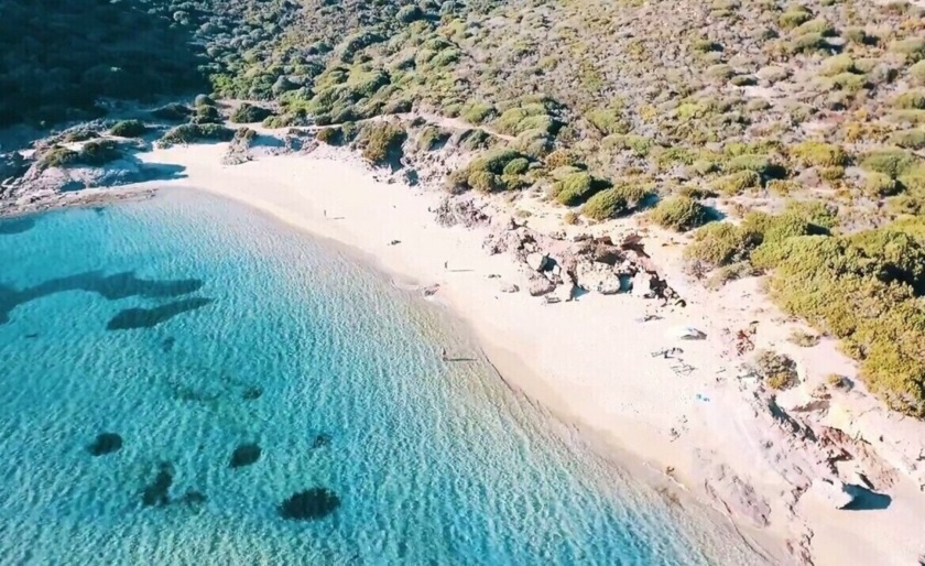
Large free beach, situated on the border between Alghero and Sassari, bordered by large dunes. It is located near the Baratz Lake, the only natural lake in Sardinia and valuable nature area. A path connects the beach to the lake area. Beaten by Mistral winds, the beach is a favoured by surfers. -
ALGHERO AREA - Cala dell'Argentiera
×
ALGHERO AREA - Cala dell'Argentiera
Coordinates: 40°44'25.1"N 8°08'51.9"E
Cala dell’Argentiera looks out onto an evocative scenery of manufacturing archaeology, formed by the Argentiera mine buildings, which over the centuries exploited the area for its rich lead, silver and zinc deposits. The mining village, closed in 1962, further amplifies the motionless atmosphere where time stands still, of this beautiful cove, that makes the shape of an arc covered by a mixture of sand, gravel and mineral dusts. The sea is extraordinarily limpid and crystalline: the light bouncing of its surface contrasts with the brown rocks that flank the beach producing a spectacular chromatic show. -
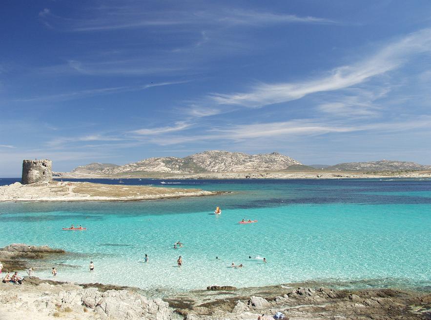
STINTINO AREA - La Pelosa
×
STINTINO AREA - La Pelosa
Coordinates: 40°57'58.1"N 8°12'33.5"E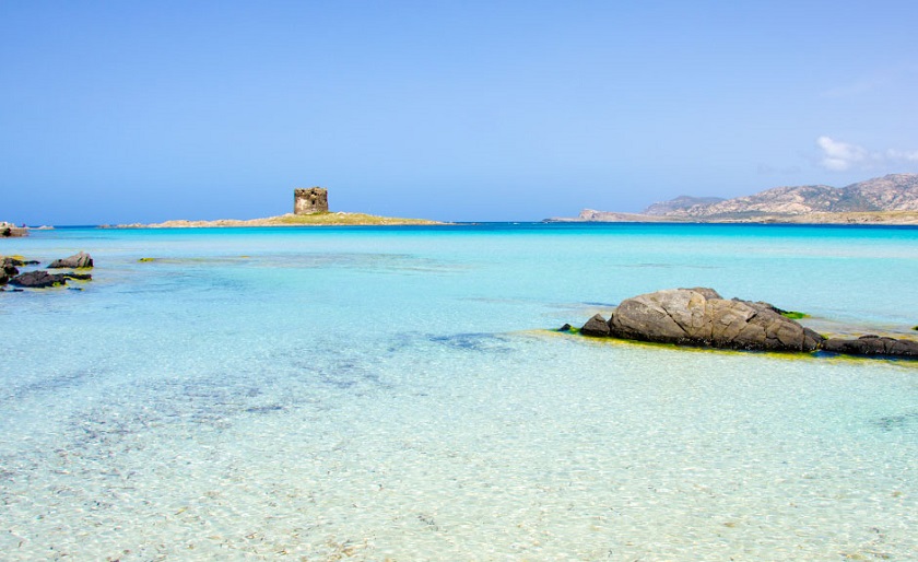
One of the most renowned beach in Sardinia. A breathtaking sandy white beach with crystal water overlooking the famous Pelosa and Falcone Towers.
It is located 2 km from Stintino, at the bottom of Capo Falcone, northern extremity of the island, close to the small fishing village. The sand is extraordinarily white and thin and it is characterized by the seventeenth-century tower of La Pelosa. Just in front of it rises the Asinara island, ex penitentiary and now park, which has become the destination of numerous tourists.
-
STINTINO AREA - Cala Lupo
×
STINTINO AREA - Cala Lupo
Coordinates: 40°56'54.4"N 8°14'04.8"E
Cala Lupo is a mixture of rocks and coarse-grained sand facing an extraordinary limpid sea , with shades that go from an emerald green to a light blue and very much appreciated by divers. The landscape in which the creek is immersed is enchanting and very striking thanks to the blooming vegetation and sharp rocks that reflect into the sea. The beach is ideal for peace and tranquillity and not very busy. -
STINTINO AREA - Le Saline
×
STINTINO AREA - Le Saline
Coordinates: 40°54'23.8"N 8°14'08.0"E
The Beach of Le Saline is far about 2-3 kilometres from Stintino. The beach name Le Saline derives by the salt works located here that was run by the monks of Santa Maria di Tergu. The beach is a long stretch of very small crushed smoothed white stones (as grains of rice). The color of the sea is blue, clear and transparent. The beach of Le Saline Stintino is a pretty popular place that is close to the structures of ancient salt mines, existing since the thirteenth century, and the abandoned buildings of the seventeenth-century. Moreover the beach is much visited by lovers of the windsurfing. -
STINTINO AREA - Ezzi Mannu
×
STINTINO AREA - Ezzi Mannu
Coordinates: 40°52'40.9"N 8°15'50.9"E
Ezzi Mannu beach extends for quite a distance and to the North connects to Le Saline beach in Stintino, and to the South with the Pilo pool and then Porto Torres. The beach covers about 4 km of coast and varies in width from between 20-40m. The scenery is stunning. The sea is transparent and azure with a sandy bottom, the sand of the beach is very fine and mixed with grains of quartz and other, coloured, minerals, and in contrast in the background, you can see the chimneys of Fiumesanto, the industrial area of Porto Torres. With respect to the beach the industrial area should be considered simply as an element of the scenery, as it does not affect the quality or possibility of visiting the beach in any way. Typical coastal vegetation grows on the small developing dunes, such as Cakile maritima, sand grasses like sand couch (Elytrigia juncea), Eryngium maritimum, and sea chamomile (Anthemis maritima). The back dune area that is normally home to junipers, has been transformed to make way for the holiday homes and cultivated fields you must cross to reach the beach. The sensation of walking through a rural landscape amidst fields and animals at pasture rather than a seaside environment is one of the unusual characteristics of this seaside area. -
CASTELSARDO AREA - Cala Ostina
×
CASTELSARDO AREA - Cala Ostina
Coordinates: 40°54'56.3"N 8°44'19.0"E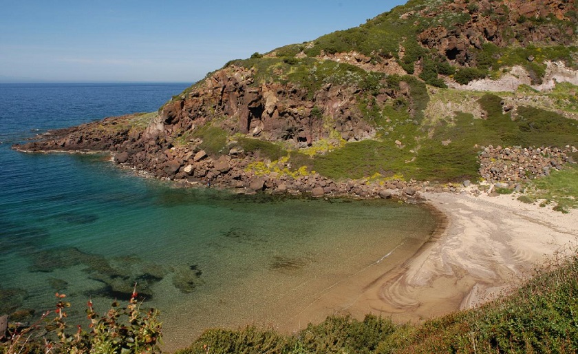
A few kilometres beyond Castelsardo, a small road leads to the charming Cala Ostina, the inlet into which the homonymous stream flows, among impending trachyte rocks which edge the sandy arc of the small beach, washed by crystalline waters. Although it appears rather secluded, it is much frequented during the summer season, also because this stretch of coast, which closes the Gulf of Asinara to the east, is quite steep and short of sandy shores. -
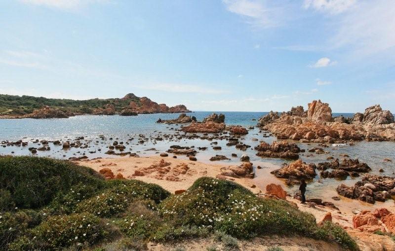
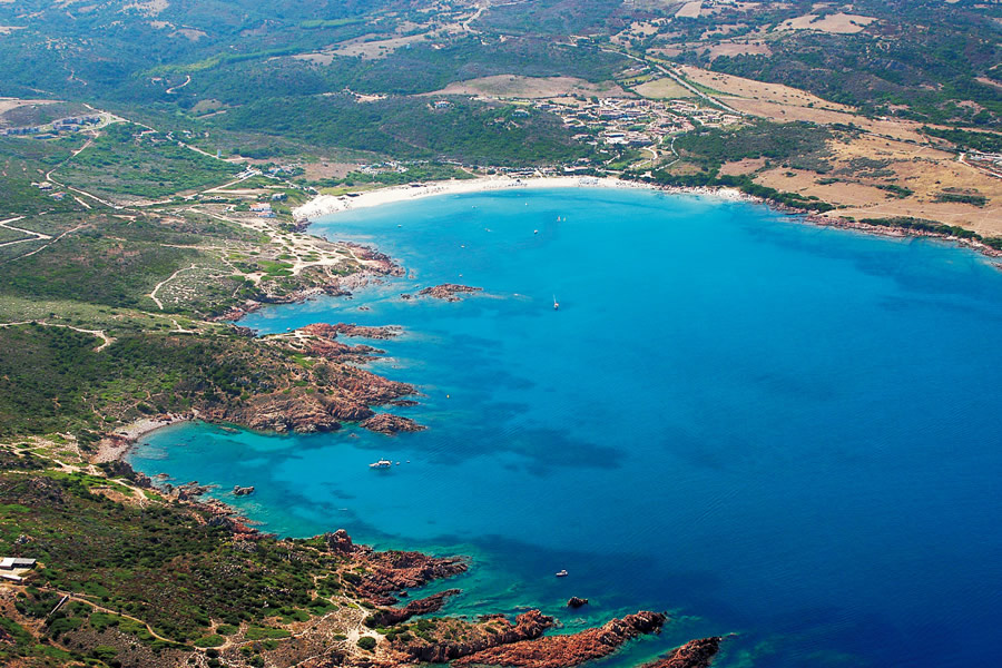
ISOLA ROSSA AREA - Spiaggia Longa
×
ISOLA ROSSA AREA - Spiaggia Longa
Coordinates: 41° 0'34.98"N 8°52'36.84"E

The nice beach is located in the centre of Isola Rossa. A big inlet between the red rocks create a beach with pink sand and a light blue water with some shades of green. The beach is also the natural stage of an enchanting sunset with the sun hiding itself and disappearing behind the rocks of the small island in the shore. -
ISOLA ROSSA AREA - La Marinedda
×
ISOLA ROSSA AREA - La Marinedda
Coordinates: 41°00'55.5"N 8°53'15.0"E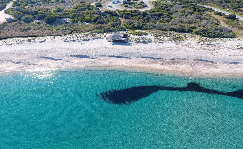
The fabulous free access beach of Marinedda, is the ideal place for those who loves quiet strolls and wants to explore the charming red rock coves on the two sides of the beach, framing transparent waters such as only Sardinia can offer, and backed by unspoilt, perfumed natural vegetation. -
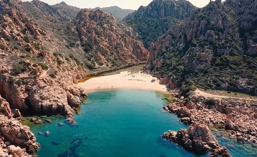
ISOLA ROSSA AREA - Cala Tinnari
×
ISOLA ROSSA AREA - Cala Tinnari
Coordinates: 41°02'01.6"N 8°55'09.5"E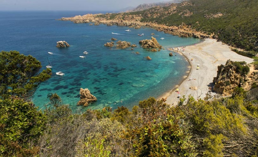
A fifteen minute drive from Isola Rossa, and access to this stunning beach is by boat or foot. The 214 m walk down is flanked with cork trees and offers a beautiful panorama of The Asinara Islands and Corsica. The walk down is not for the faint of heart. It’s a rugged, often unstable path which winds its way slowly down the 214 m mountain. Tinnari is compromised of two small half-moon bays and the beach is formed from small fragments of sea shells, granite rocks and round coloured pebbles which have ebbed and flowed for eons. -
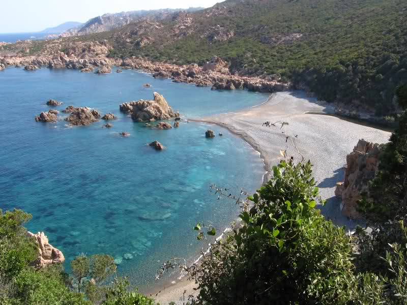
ISOLA ROSSA AREA - Cala Li Cossi
×
ISOLA ROSSA AREA - Cala Li Cossi
Among the most well known beaches in Sardinia, Li Cossi it is a corner of great beauty and evocativeness, whose peculiar characteristic is that of being positioned within in a wind-sheltered cove, enclosed between rocks and bluffs of pink trachyte, that stand out imposing on the green sea. The shallow waters and gentle sea shelf allow children to swim and play freely. The beach owes its name to the Li Cossi river that crosses it, forming a small pond to its rear.
The variegated sea depths, full of fish, in some places most spectacular, are much loved by scuba divers and snorkellers.