s coast
from Muravera to Porto Pino
Anchorages
Hide MapIf you want to continue the navigation, please sign up
Request your temporary Access Code
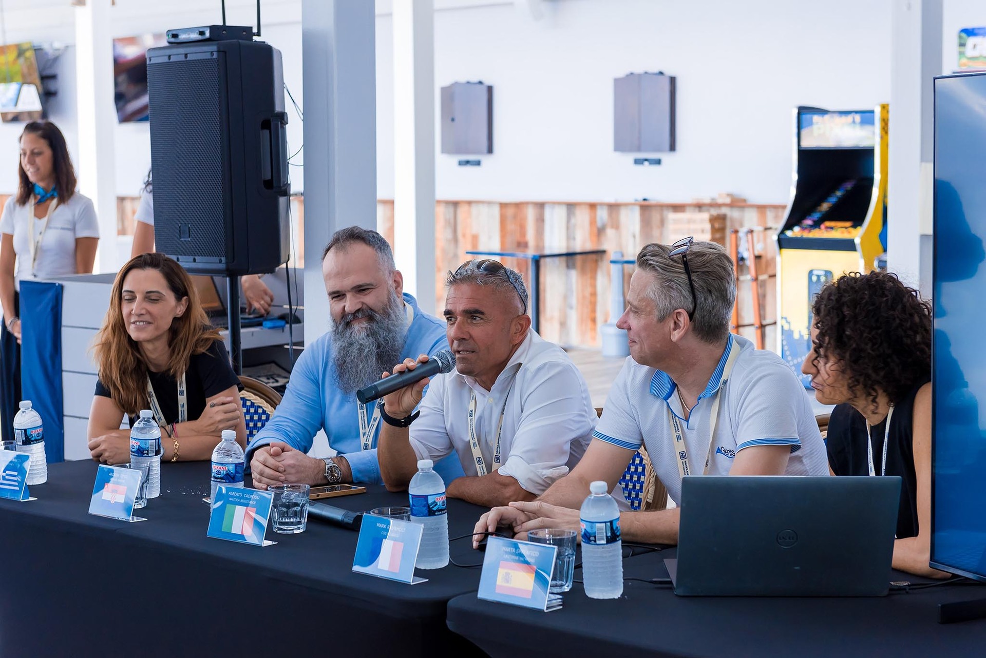
This operational platform has been created to help yacht captains, yacht brokers, crew members, yacht agents and all people involved in the yachting industry to find in our DISCOVER SARDINIA section the right operational tool for cruising Sardinia. Nautica Assistance reserves the right to accept or decline the registration. Once accepted you will be receiving an access code with a validity of six months.
-
CAGLIARI AREA - Mari Pintau
×

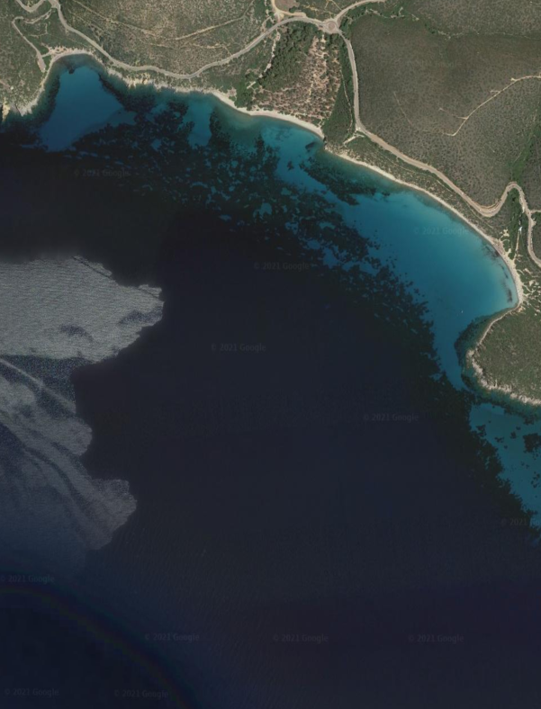
CAGLIARI AREA - Mari Pintau
A spectacular beach with smooth stones washed by the deep blue sea, a colour that you will only see in these locations on the southern coast of Sardinia, a few kilometres away from Cagliari. Well protected bay from the Northerly wind. Good holding on sandy bottom.GENERAL RESTRICTIONS:- Navigation within 200 m from the coast
- Anchoring within 200 m from the coast
- 10 knots speed limit within 1 km from the coast
- Running any craft within 200 m from the coast with engines on
- Tying lines to rocks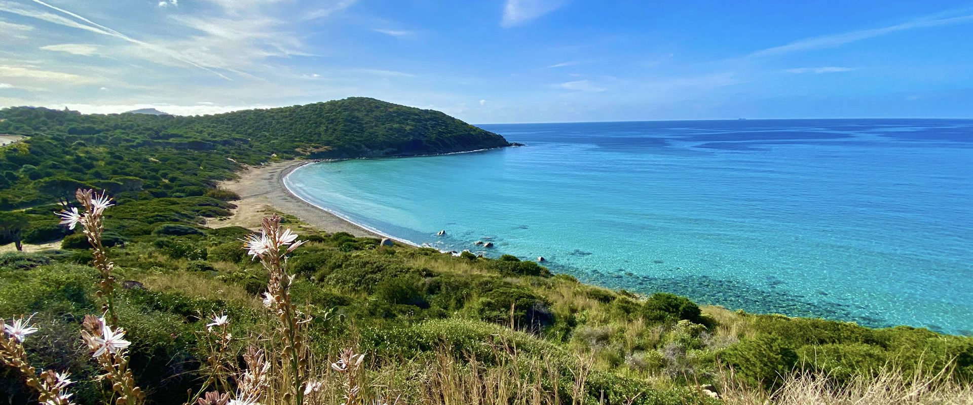
ANCHORAGE NAME CAGLIARI AREA - MARI PINTAU COORDINATES 39°10'20"N9°22'11"E HIGHLIGHTS NATURAL BEAUTY SHELTERED FROM N-NE-E WINDS LIMITS AND PROHIBITIONS NO FURTHER RESTRICTIONS SEABOTTOM SAND FACILITIES TO LAND ASHORE NONE FACILITIES ASHORE NONE CLOSER DROP OFF POINT CAPITANA NEAREST COASTGUARD STATION CAGLIARI -
PULA AREA - Nora
×
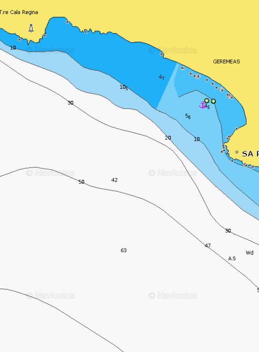
PULA AREA - Nora
The area is immersed in a breathtaking panorama. Behind the promontory lies the Nora Lagoon and on the south side the Archaeological Ruins of Nora, which are the landmark of Sardinia’s grandeur in the Roman era, after a period of domination by Carthage in 238 BCE. During this golden age, the city flourished and neighborhoods were created a few meters away from the sea, as well as ancient cobbled streets that still today are more than surprising.
Southerly swell enters the bay as it wraps around the headland of Capo di Pula. Very good holding in the NW corner even in strong winds, anchoring in 4-5 m.
Beware of the reefs along the beach on the Western side of the bay.GENERAL RESTRICTIONS:- Navigation within 200 m from the coast
- Anchoring within 200 m from the coast
- 10 knots speed limit within 1 km from the coast
- Running any craft within 200 m from the coast with engines on
- Tying lines to rocks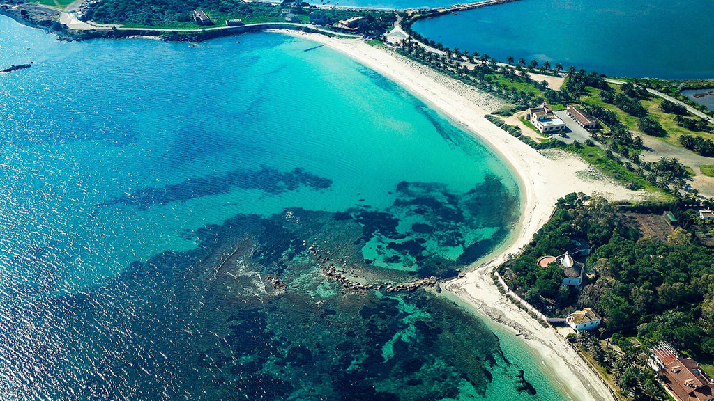
ANCHORAGE NAME NORA COORDINATES 38°59'39"N9°1'9"E HIGHLIGHTS NATURAL BEAUTY SHELTERED FROM N-NW-W-SW WINDS LIMITS AND PROHIBITIONS NO FURTHER RESTRICTIONS SEABOTTOM SAND FACILITIES TO LAND ASHORE YES FACILITIES ASHORE YES CLOSER DROP OFF POINT PERD'E SALI MARINA NEAREST COASTGUARD STATION CAGLIARI -
TUERREDDA AREA - Tuerredda (Capo Malfatano)
×
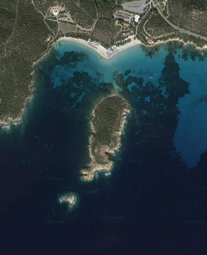
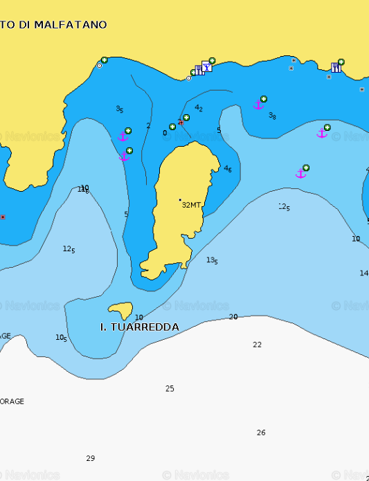
TUERREDDA AREA - Tuerredda (Capo Malfatano)
This calm and very pleasant cove is sheltered in part by Tuerredda island which is separated from the mainland by an isthmus barely submerged. There is a shelter between the Malfatano Cape tower and the S of Tuerredda Island, by 15 m, or on the other side, on the alignment of the tower, by the rock located E of the island.
Very large beautiful beach, with a restaurant and bar (tender landing), there is a bit of seaweed but you can find some puddles of sand, the only sore point is the passage of many boats and motorized rafts.
In case of extreme weather conditions, it's recommended to move further west, in the inlet of Capo Malfatano, where there is good protection from any wind. Crystal clear water makes it easier to avoid the algae, anchoring with about 3-5 meters over the whole area, with the exception of the northern bay area due to shallow waters.
GENERAL RESTRICTIONS:
- Navigation within 200 m from the coast
- Anchoring within 200 m from the coast
- 10 knots speed limit within 1 km from the coast
- Running any craft within 200 m from the coast with engines on
- Tying lines to rocks
VIEW MAPS ON: NAVIONICS.COM - GOOGLE EARTH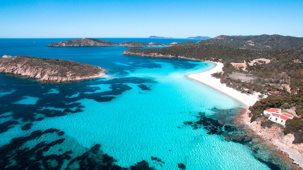
ANCHORAGE NAME TUERREDDA COORDINATES 38° 53' 35" N, 8° 48' 38" E HIGHLIGHTS NATURAL BEAUTY SHELTERED FROM SW-W-NW-N-NE-E-SE WINDS LIMITS AND PROHIBITIONS NO FURTHER RESTRICTIONS SEABOTTOM SAND, ROCKS FACILITIES TO LAND ASHORE NO FACILITIES ASHORE BEACH BAR, RESTAURANT CLOSER DROP OFF POINT TUERREDDA NEAREST COASTGUARD STATION CAGLIARI -
TEULADA AREA - Cala Piscinni
×
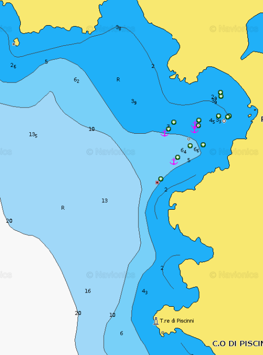
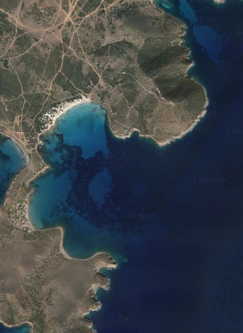
TEULADA AREA - Cala Piscinni
This cove is very beautiful and we can anchor in crystalline water by 3 to 13 m. Also a good place to be except with S winds. Excellent anchorage on sand. Excellent shelter even with strong sirocco. Beautiful landscape sheltered from eastern and south-easter winds.
GENERAL RESTRICTIONS:
- Navigation within 200 m from the coast
- Anchoring within 200 m from the coast
- 10 knots speed limit within 1 km from the coast
- Running any craft within 200 m from the coast with engines on
- Tying lines to rocks
VIEW MAPS ON: NAVIONICS.COM - GOOGLE EARTH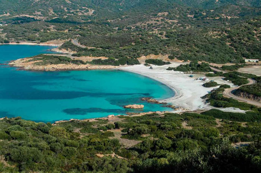
ANCHORAGE NAME CALA PISCINNI COORDINATES 38° 54' 39" N, 8° 46' 45" E HIGHLIGHTS NATURAL BEAUTY SHELTERED FROM N-NE-E-SE WINDS LIMITS AND PROHIBITIONS NO FURTHER RESTRICTIONS SEABOTTOM SAND FACILITIES TO LAND ASHORE NO FACILITIES ASHORE BEACH BAR, RESTAURANT CLOSER DROP OFF POINT TEULADA PORT NEAREST COASTGUARD STATION CAGLIARI -
TEULADA AREA - Porto Zafferano
×
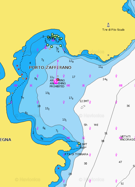
TEULADA AREA - Porto Zafferano
Please note: anchoring forbidden.
Anchorage is not allowed including part of Porto Pino.
Cala Zafferano, for example, can only be visited transiting for a dive but you can't anchor or get to the beach as it is military zone.GENERAL RESTRICTIONS:
- Navigation within 200 m from the coast
- Anchoring within 200 m from the coast
- 10 knots speed limit within 1 km from the coast
- Running any craft within 200 m from the coast with engines on
- Tying lines to rocks
VIEW MAPS ON: NAVIONICS.COM - GOOGLE EARTH
ANCHORAGE NAME PORTO ZAFFERANO COORDINATES 38°53'24.9"N 8°39'35.8"E HIGHLIGHTS NATURAL BEAUTY SHELTERED FROM N-NW-W-SW WINDS LIMITS AND PROHIBITIONS NO FURTHER RESTRICTIONS SEABOTTOM SAND FACILITIES TO LAND ASHORE NO FACILITIES ASHORE NO FACILITIES ON THE SHORE CLOSER DROP OFF POINT TEULADA PORT NEAREST COASTGUARD STATION CAGLIARI -
TEULADA AREA - Porto Pino
×
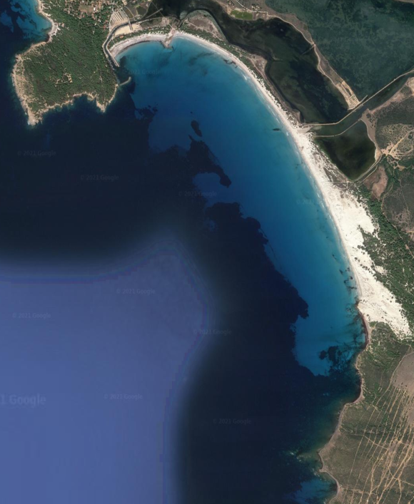
TEULADA AREA - Porto Pino
Porto Pino is bordered in its S part by a rocky coastline with high dunes, while the N coast has a shallow beach. The tip Menga limits Porto Pino W. A lagoon, behind the sand dunes, hosts several colonies of flamingos. This huge sandy bay provides anchorage without any problem at all depths, far enough from the beach as the background goes very slowly. Good anchorage at 4 m. just outside the mouth of the river. Excellent protection from N / NW waves, less wind protection as the headland is low.
GENERAL RESTRICTIONS:
- Navigation within 200 m from the coast
- Anchoring within 200 m from the coast
- 10 knots speed limit within 1 km from the coast
- Running any craft within 200 m from the coast with engines on
- Tying lines to rocks
VIEW MAPS ON: NAVIONICS.COM - GOOGLE EARTH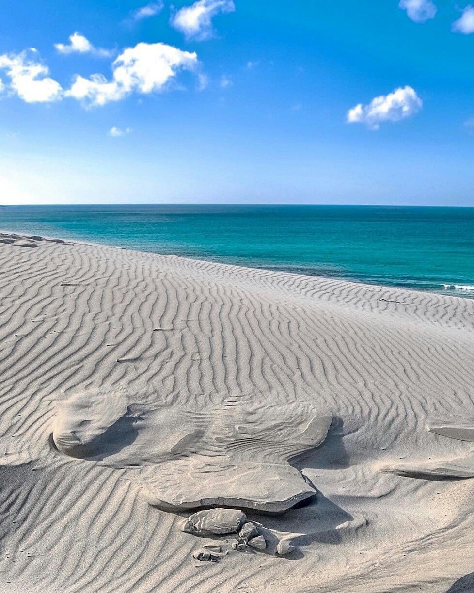
ANCHORAGE NAME PORTO PINO COORDINATES 38°57'30"N 8°36'02"E HIGHLIGHTS IS ARENAS BIANCAS BEACH DUNES SHELTERED FROM NE-E-SE WINDS LIMITS AND PROHIBITIONS NO FURTHER RESTRICTIONS SEABOTTOM SAND FACILITIES TO LAND ASHORE YES FACILITIES ASHORE BEACH BAR, RESTAURANT, FACILITIES CLOSER DROP OFF POINT PORTO PINO DOCK NEAREST COASTGUARD STATION CAGLIARI