n coast
from Santa Teresa to Maddalena's islands
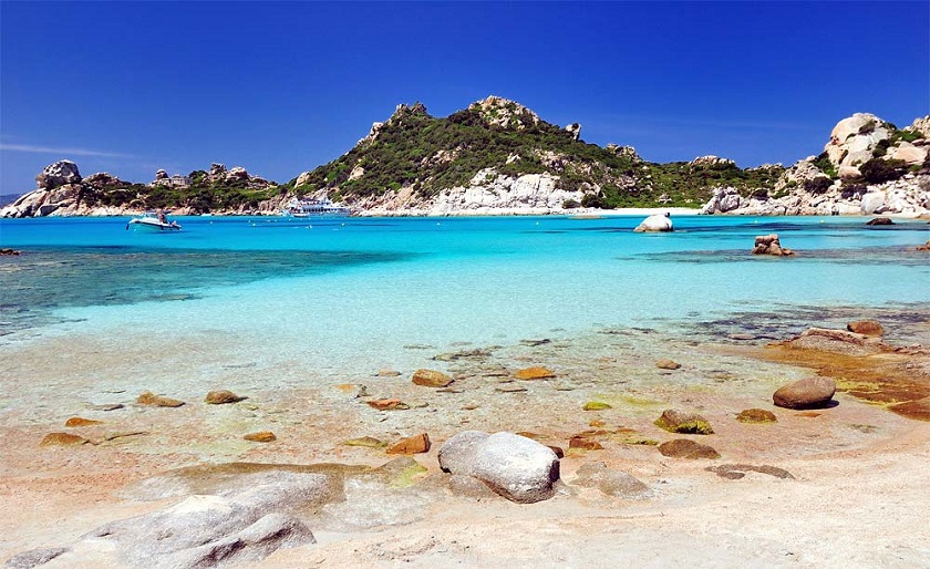
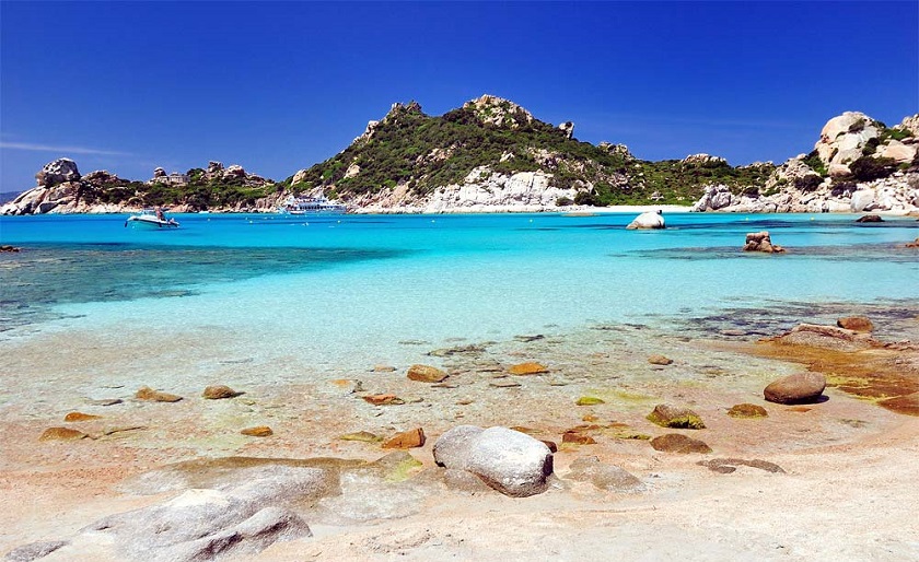
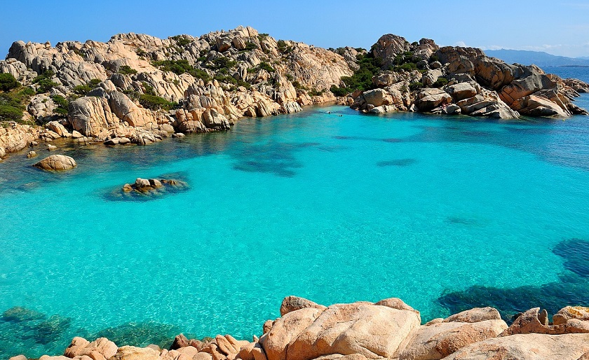
Beaches
If you want to continue the navigation, please sign up
Request your temporary Access Code
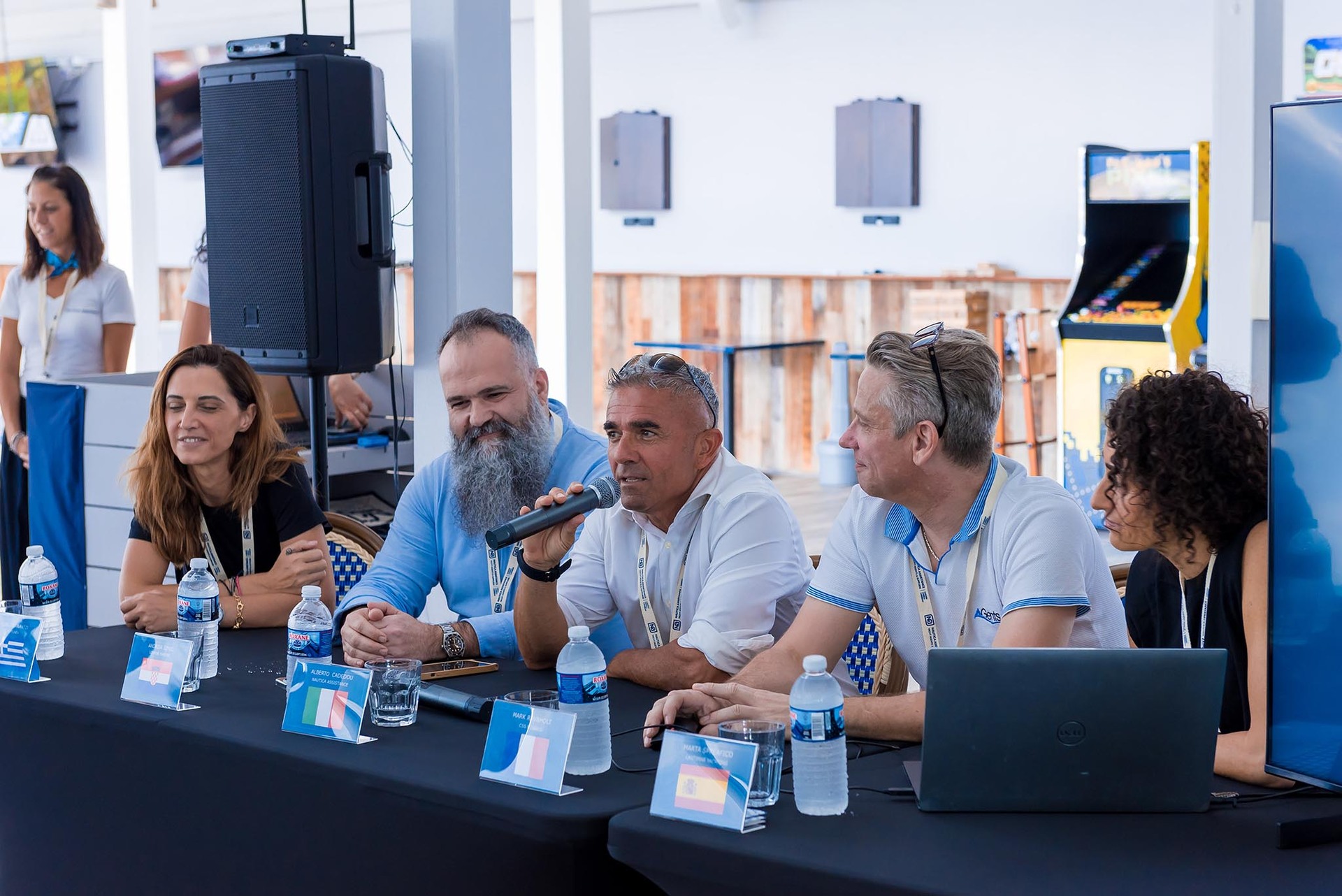
This operational platform has been created to help yacht captains, yacht brokers, crew members, yacht agents and all people involved in the yachting industry to find in our DISCOVER SARDINIA section the right operational tool for cruising Sardinia. Nautica Assistance reserves the right to accept or decline the registration. Once accepted you will be receiving an access code with a validity of six months.
-
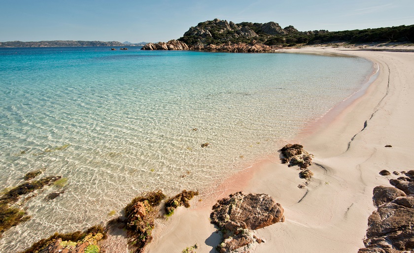
SANTA TERESA AREA DI GALLURA AREA - La Liccia Beach
×
SANTA TERESA AREA DI GALLURA AREA - La Liccia Beach
-
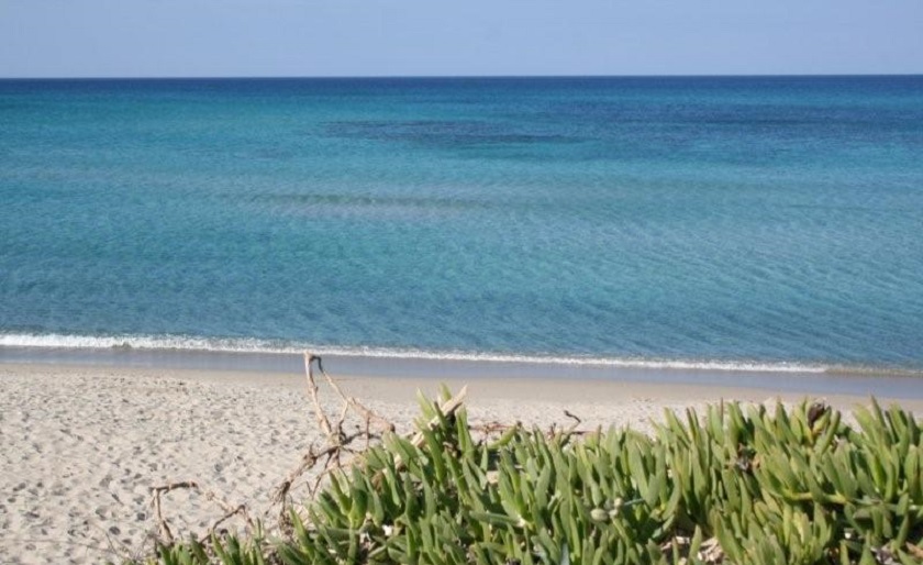
SANTA TERESA AREA DI GALLURA AREA - Cala Marmorata
×
SANTA TERESA AREA DI GALLURA AREA - Cala Marmorata

The beach of la Marmorata is located at 5 km. far from the village of Santa Teresa di Gallura. It consists of two beaches even though the biggest is mainly bound to the clients of the big hotel located close to La Marmorata. From the beach it is possible to enjoy the view of the Marmorata Islands which are reachable also by swimming. On the islands it is possible to visit the ruins of an ancient Roman granite cave. The sea bed is low. -
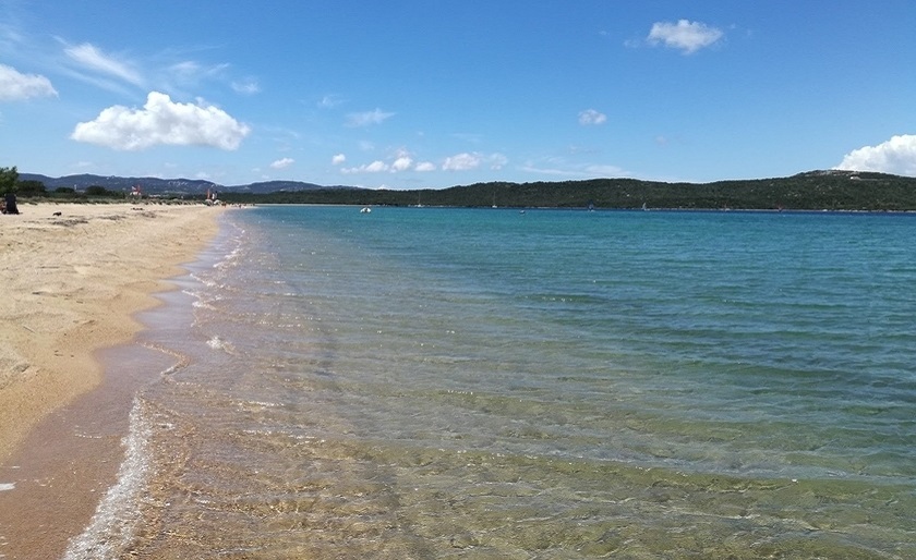
PALAU AREA - Porto Liscia
×
PALAU AREA - Porto Liscia

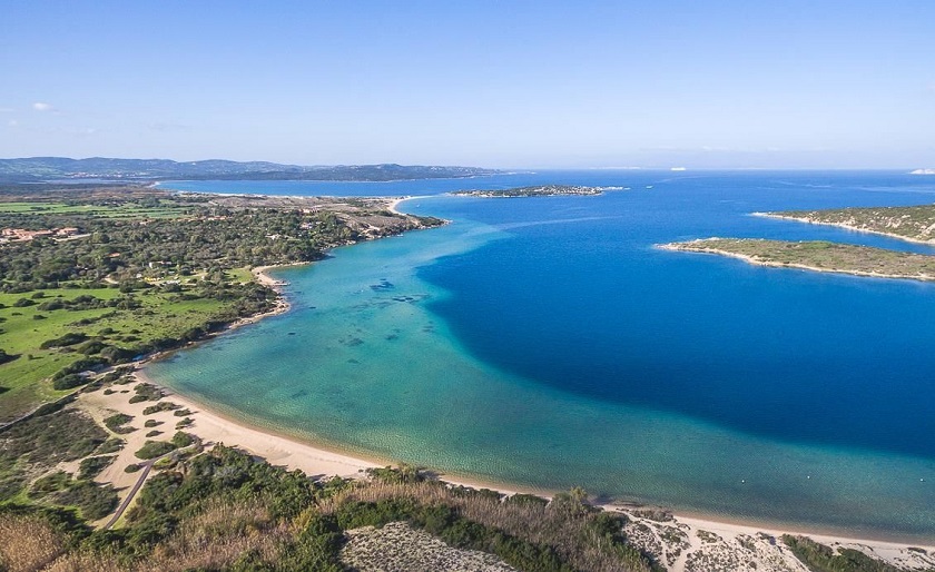
Porto Liscia is the longest beach in Santa Teresa Area, covering a surface of 8 kilometers along the coast. It has a golden sand bottom with shallow and crystalline water. The beach is renowned for being a very famous destination among surfers and windsurfers, thanks to its exposition to northerly and northwesterly winds. The Liscia river flows into its waters. -
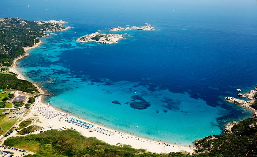
PALAU AREA - Porto Pollo
×
PALAU AREA - Porto Pollo
 Porto Pollo beach is located about 1 kilometer from Porto Pollo village, in Palau, Olbia-Tempio. This beach is the epicentre of kitesurfing in Sardinia, as this spot has some of the best wind conditions in Europe. Porto Pollo beach is also very suitable for windsurfing, sailing and even for diving, canoeing and mountain biking. The total length of the beach is near 3.5 kilometers, offering wonderful views of Isola dei Gabbiani to the north, the Maddalena Archipelago to the north-east, and Corsica to the north-west. The area around Porto Pollo beach has many restaurants, bars, resorts and surfing schools to choose from. A must-see, especially if you enjoy water sports.
 - PALAU AREA - Barca Bruciata Beach
-
LA MADDALENA AREA - Cala Francese - Carlotto
×
LA MADDALENA AREA - Cala Francese - Carlotto
 Cala Francese is a beautiful cove on the west coast of the Maddalena island, sheltered from the northern winds. It’s surrounded by a system of small bays and a rocky reef, mainly made up of granite, which gives the sand beautiful pink shades. Apart from a couple of rocks on both sides, the sea bottom is mostly sandy. The pink granite extracted from Cava Francese, near the beach, was also used for the construction of the Statue of Liberty.
 -
LA MADDALENA AREA - Spiaggia Monti d'a Rena
×
LA MADDALENA AREA - Spiaggia Monti d'a Rena
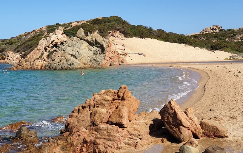
It is nestled along the meandering northern coast of the Island, unsheltered from the boisterous northern and north western winds which keep the water clear and cool. A towering sand dune surrounded by junipers and rock roses make it unique and easily recognizable. From the centre of La Maddalena, proceed for about 8 km on the panoramic road. - LA MADDALENA AREA - Cala Corsara
- LA MADDALENA AREA - Cala Coticcio
-
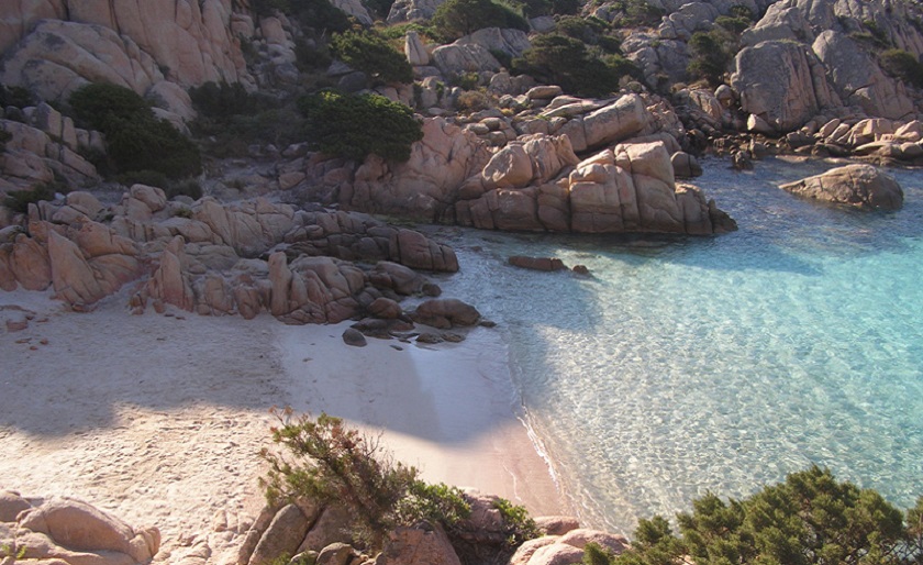
LA MADDALENA AREA - Spiaggia Rosa
×
LA MADDALENA AREA - Spiaggia Rosa
 Fine white sand onto which myriads of pieces of shells and coral create pearly pink reflections. Pink rocks bordering the profile and a turquoise sea, deep and unreal the way some dreams are.
Transit, anchoring or stopping of any vessel, underwater activities and bathing in the area between the line of the shore and the round boundary buoys, accessand trampling on the shore are prohibited.