olbia area
from Golfo Aranci to San Teodoro
Beaches
If you want to continue the navigation, please sign up
Request your temporary Access Code
This operational platform has been created to help yacht captains, yacht brokers, crew members, yacht agents and all people involved in the yachting industry to find in our DISCOVER SARDINIA section the right operational tool for cruising Sardinia. Nautica Assistance reserves the right to accept or decline the registration. Once accepted you will be receiving an access code with a validity of six months.
-
OLBIA AREA - Cala Moresca
×
OLBIA AREA - Cala Moresca
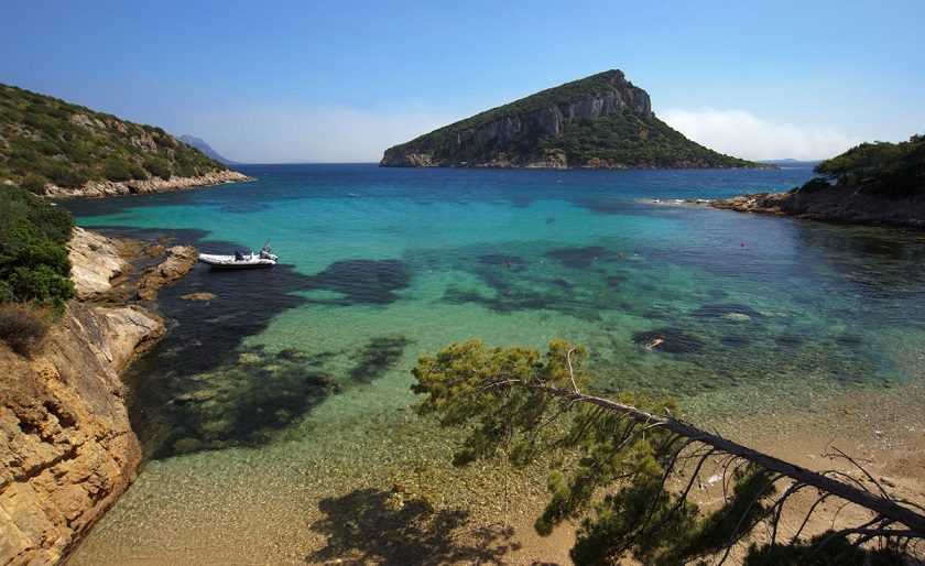 The beach of Cala Moresca is located at about 2,5 km. far from the town of Golfo Aranci, just opposite of the oxbow of Figarolo, along the northeastern coast of Sardinia. The suggestive Cala Moresca is a sandy and rocky bay overhung by a pineforest. After Cala Moresca the road ends so the other beaches on the promontory of Capo Figari (Cala Greca e Cala del Sonno) are reachable only by boat or on foot, through an impervious path among rocks. The seabed is low, guaranteeing a safe space for children, and the beach is also appreciated among divers and snorkellers.
 -
OLBIA AREA - Spiaggia Bianca
×
OLBIA AREA - Spiaggia Bianca

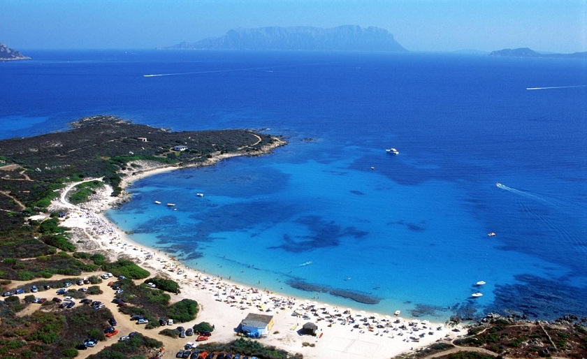
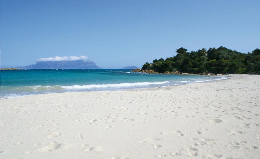
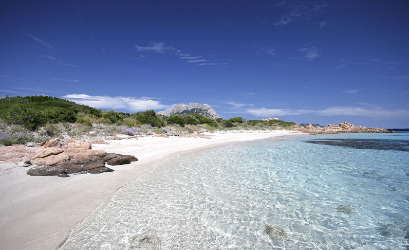
Spiaggia Bianca beach is located on the parkway that from Olbia leads to Golfo Aranci, along the northeastern coast of Sardinia. It is a large beach with crystal clear water, fine sand and a stunning view on the Tavolara Island. This beach is also a common destination for watersports' lovers, and is equipped with a wheelchair access. The seabed is quite low, making the place suitable for families with children. -
OLBIA AREA - Cala Sassari
×
OLBIA AREA - Cala Sassari
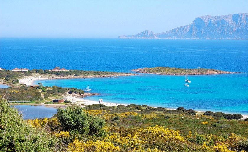
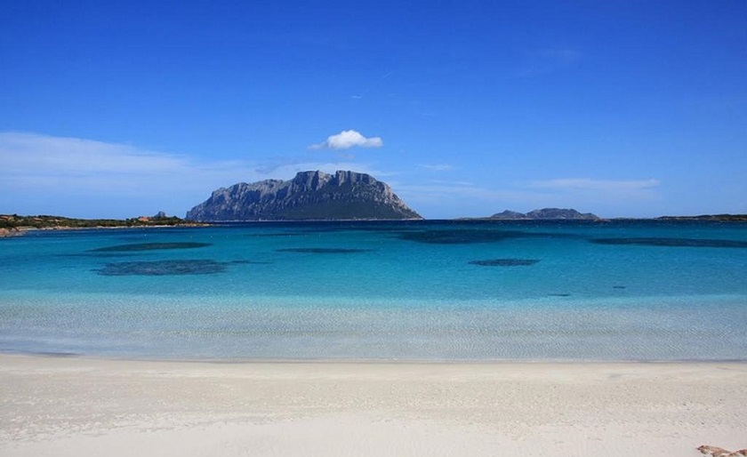
Cala Sassari is located before the town of Golfo Aranci. This large creek is characterized by crystal clear water, white sand and some granitic rocks. The beach is also bordered by two promontories that protect the cove from Mistral wind. The shallowness of the water let children swim and play without dangers. -
OLBIA AREA - Cala Banana - Nodu Pianu
×
OLBIA AREA - Cala Banana - Nodu Pianu
-
OLBIA AREA - Pittulongu
×
OLBIA AREA - Pittulongu

The wide Lido di Pittulongu (Pittulongu seaside) is located on the road that from Olbia takes to Golfo Aranci, 8 km far from the town. The beaches that are part of the lido are beautiful and really appreciated. The first beach is called "La Playa" which is the most favourite of local people, and offers lots of facilities such as beach umbrella and deck chairs on hire, restaurants and bars right in front of the beach where you can enjoy an amazing view on Tavolara Island. After La Playa the next beaches are the Squalo (the shark) and the Pellicano (the pelican) beach, smaller than La Playa but not less welcoming. Up ahead reachable on foot, there is the beach of Mare e Rocce divided from the other two by a group of stones. It is a beautiful beach with a nice bar opened all day long. -
OLBIA AREA - Capo Ceraso
×
OLBIA AREA - Capo Ceraso
 Punta Capo Ceraso is located South from Olbia, about 15 km and includes some nice coves: Cala sa Figu, Sos Passizzedos, Porto Lucas e Porto Vitello. Short beaches surrounded by Mediterranean scrub and pink granite rocks. The water is renowned for the variety of colours in the whole bay: from the white foreshore to the emerald green and deep blue.
 -
OLBIA AREA - Porto Istana
×
OLBIA AREA - Porto Istana

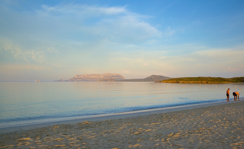
The beach of Porto Istana is located in the small village of Murta Maria, South of Olbia. Sited in a stretch of coast that is one of the most beautiful in Sardinia, lapped by an emerald-green sea opposite the Island of Tavolara, the beach is also well connected to Olbia by a bus service. This beach is quite appreciated by local people, especially thanks to its shallow waters and wonderful colors. -
OLBIA AREA - Isola Piana
×
OLBIA AREA - Isola Piana
 The beach has fine grey-coloured sand with pink and ochre reflections, and there are also a number of rocky outcrops. Lying within the Marine Park, the Isola dei Cavalli has a little beach which peeks out on the southern side, with characteristic tropical colours, ranging between azure and turquoise blue, interrupted by rocky outcrops with pinkish-yellowy colours.
 -
OLBIA AREA - Cala Spalmatore (Tavolara Island)
×
OLBIA AREA - Cala Spalmatore (Tavolara Island)
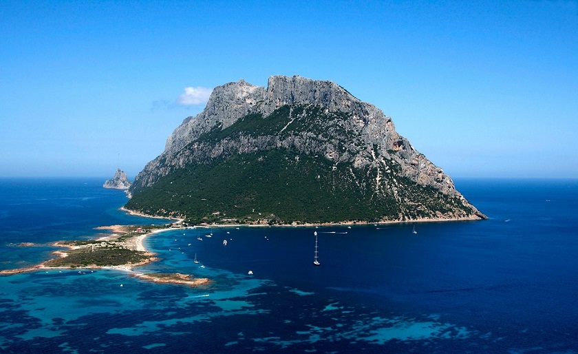 A cove and beach can be found at each end of the island, Spalmatore di Fuori at the northeast, and Spalmatore di Terra at the southwest. Currently, the island is inhabited by only a handful of families, and has a small cemetery and summer restaurant. The water around the island is a popular spot for scuba diving.
 -
OLBIA AREA - Cala Chiesa (Molara Island)
×
OLBIA AREA - Cala Chiesa (Molara Island)
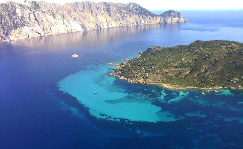
Cala Chiesa (Church Cove), a little east of Cala Spagnola. Close to the shore, among wild olives, there are the ruins of the church of Saint Ponziano, a Pope who was allegedly banished from Rome and died in Tavolara (IIIrd century). Surrounded by remains of "cumbessias", buildings used as shelters for believers on the day of the Patron's feast, the church still preserves a small apse. In Cala Chiesa is also located the village of Gurguary, the only surviving example of a medieval village in Sardinia. Currently, the island is owned by an Olbia-based family and visits are only allowed along the coast. Cala di Chiesa are the sandy shores of Molara. -
OLBIA AREA - Capo Coda Cavallo
×
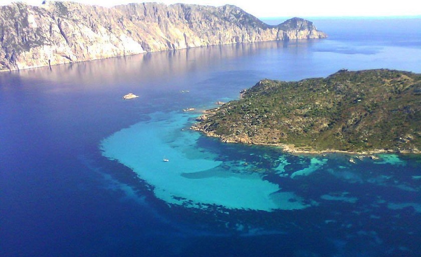
OLBIA AREA - Capo Coda Cavallo

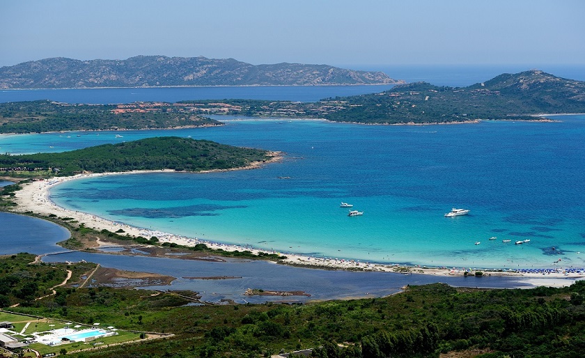
The beach of Capo Coda Cavallo is located between Olbia and San Teodoro, in the province of Nuoro. From the height of its position, it offers the view of a panorama “infinitely and breathtaking” where the waters encircle Molara and Molarotto, they insinuate themselves between the coasts, some visible and visited, others hidden and uncontaminated for a perturbing show. From the summit of the panoramic Monte Coda Cavallo, which is within easy walking distance, one sees: to the southward, the lovely coast of San Teodoro, with the long, white expanse of La Cinta beach and the large pond of San Teodoro, near the village. To the North, the above the island of Proratora, not far from the headland’s shore and, in the distance, the verdant island of Molara and the impeding bulk of the wild Tavolara. -
OLBIA AREA - Cala Brandinchi
×
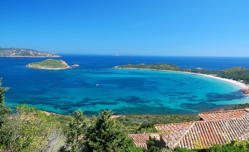
OLBIA AREA - Cala Brandinchi
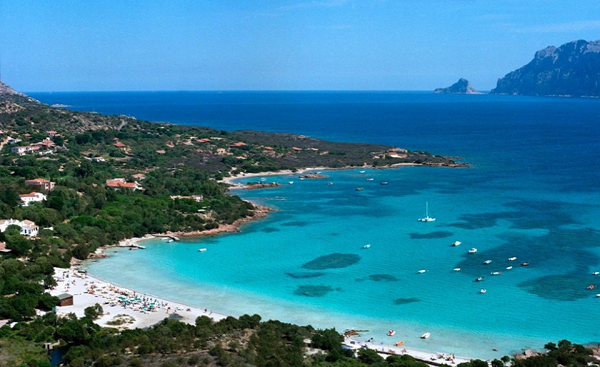
The stunning Brandinchi beach is located between Punta Sabbatino and Capo Codacavallo, along the Olbia - San Teodoro road. It is a wonderful beach, characterized by a very fine sand and clear depth, and colours that go from a light to an intense blue, also called "Tahiti", due to its beauty. Quite frequently big and soft sand dunes emerge from the shallow waters of the beach, offering an almost heavenly panorama. Among the dunes behind the beach it's easy to find wild lilies. On the beach you can also find beach-umbrellas and deck-chairs rental and a few kiosks.