olbia area
from Golfo Aranci to San Teodoro
Anchorages
Hide MapIf you want to continue the navigation, please sign up
Request your temporary Access Code
This operational platform has been created to help yacht captains, yacht brokers, crew members, yacht agents and all people involved in the yachting industry to find in our DISCOVER SARDINIA section the right operational tool for cruising Sardinia. Nautica Assistance reserves the right to accept or decline the registration. Once accepted you will be receiving an access code with a validity of six months.
-
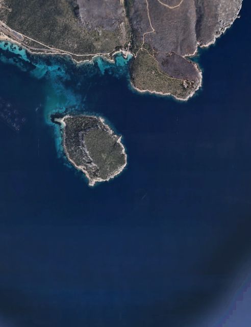
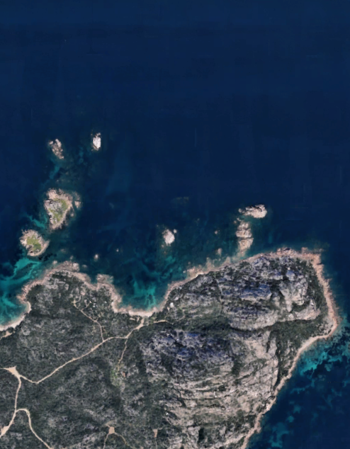
OLBIA AREA - Cala Moresca
×

OLBIA AREA - Cala Moresca
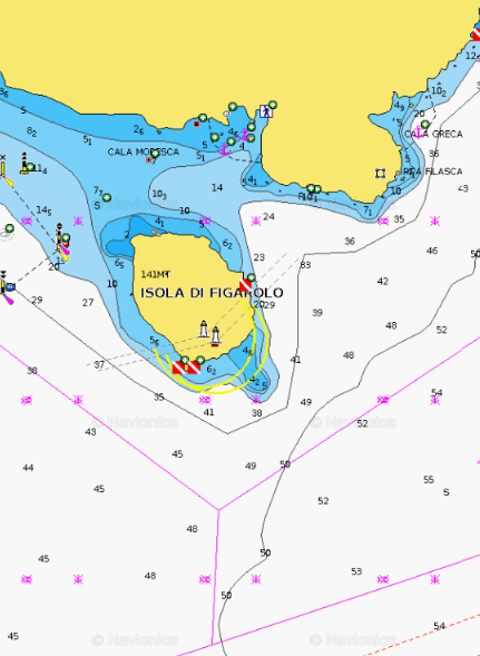
Cala Moresca beach (Spiaggia di Cala Moresca), is a secluded bay near Spiaggia Bianca, with two beaches, near the end of the railroad tracks that lead to the village of Golfo Aranci. Backed by a pine forest which can easily reached on foot or by bicycle, Cala Moresca features impressive cliffs and rock formations, scattered pine trees, golden sands, and waters of true Caribbean quality. Behind Cala Moresca beach you’ll find a trail that leads to the old Cape Figari lighthouse on a 340 meters high mountain, offering a splendid view of Isola Figarolo, situated 500 meters off the coast of Cala Moresca beach, and Isola Tavolara in the far distance. Another trail runs along the southern side of the mountain, and leads to Cala Greca, a small beach that is only reachable on foot or by boat.
Good protection from all winds except those coming from SE. Anchorage by 6 to 10 m, S Figari cape, behind Figarolo island, N Aranci gulf. That small bay is divided into two coves fringed by sandy beach.
General Restrictions:- Navigation within 200 m from the coast
- Anchoring within 200 m from the coast
- 10 knots speed limit within 1 km from the coast
- Running any craft within 200 m from the coast with engines on
- Tying lines to rocks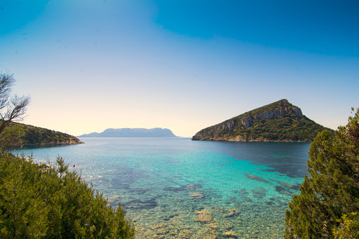
ANCHORAGE NAME OLBIA AREA - CALA MORESCA COORDINATES 40°59'06.5"N 9°38'42.1"E HIGHLIGHTS NATURAL BEAUTY, HIKING, DIVING SHELTERED FROM NW - N - NE - SW - S WINDS LIMITS AND PROHIBITIONS NO FURTHER RESTRICTIONS SEABOTTOM SAND FACILITIES TO LAND ASHORE NONE FACILITIES ASHORE NONE CLOSER DROP OFF POINT GOLFO ARANCI TOURISTIC PORT NEAREST COASTGUARD STATION GOLFO ARANCI -
OLBIA AREA - Golfo Aranci
×
OLBIA AREA - Golfo Aranci
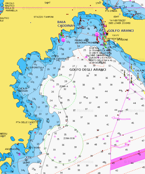
In Gallura, in the northeastern coast of Sardinia, there are little pieces of paradise facing the town’s houses and arranged one after the other: they are made of thin, white sand, similar to flour, and bottom the colour of the sky. Golfo Aranci is one of them.
A strip of land along the sea in the northeastern tip of the island, less than twenty kilometres from Olbia and only a few minutes from the Emerald Coast. The promontory of Capo Figari dominates the coast, made of fine-sand beaches and shallow bottom for tens of metres, an underwater world ready to be discovered, with surprising diving points such as Città delle Nacchere, Capo Filasca and la Roccia del Mamuthone (literally, “Big Mammoth Rock”). Surrounded by Mediterranean scrub, here are the five “city” beaches, perfect for families with children and teenagers, in particular those interested in windsurfing, with parking areas, bars and beach resorts.Anchor at least at 200 metres from the last buoy of Golfo Aranci Buoy Camp.
Watersports are forbidden inside the Buoy Camp.GENERAL RESTRICTIONS:- Navigation within 200 m from the coast
- Anchoring within 200 m from the coast
- 10 knots speed limit within 1 km from the coast
- Running any craft within 200 m from the coast with engines on
- Tying lines to rocks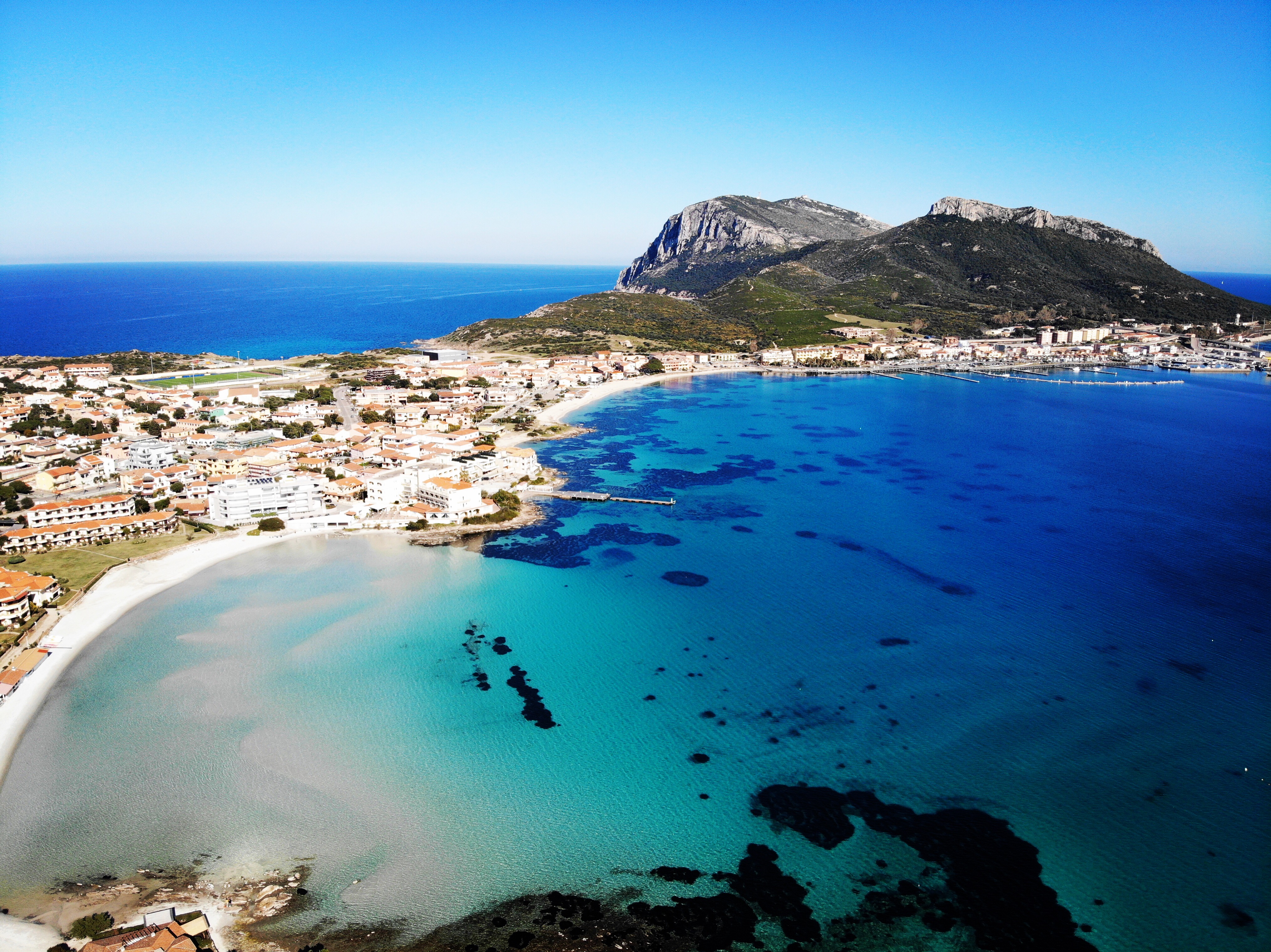
ANCHORAGE NAME OLBIA AREA - GOLFO ARANCI COORDINATES 40°59'46.9"N9°37'14.8"E HIGHLIGHTS GOLFO ARANCI VILLAGE SHELTERED FROM NW - N - NE WINDS LIMITS AND PROHIBITIONS NO WATER SPORTS INSIDE THE BUOY CAMP SEABOTTOM SAND FACILITIES TO LAND ASHORE NONE FACILITIES ASHORE YES CLOSER DROP OFF POINT GOLFO ARANCI TOURISTIC PORT NEAREST COASTGUARD STATION GOLFO ARANCI -
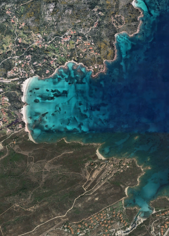
OLBIA AREA - Spiaggia Bianca
×
OLBIA AREA - Spiaggia Bianca
Spiaggia Bianca, located between the town of Golfo Aranci and Olbia is a large creek characterized by crystal clear water, white sand and some granitic rocks.
The beach is curved, faces south looking out over the Bay of Olbia, giving a mesmerizing view of Isola Tavolara in the distance.
Spiaggia Bianca is about 350 meters long, perfect for children that will enjoy swimming and playing here, since its waters are shallow.GENERAL RESTRICTIONS:- Navigation within 200 m from the coast
- Anchoring within 200 m from the coast
- 10 knots speed limit within 1 km from the coast
- Running any craft within 200 m from the coast with engines on
- Tying lines to rocks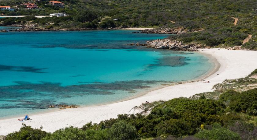
ANCHORAGE NAME OLBIA AREA - SPIAGGIA BIANCA COORDINATES 40°59'20"N,9°35'32"E HIGHLIGHTS NATURAL BEAUTY SHELTERED FROM W-NW-N-NE WINDS LIMITS AND PROHIBITIONS NO FURTHER RESTRICTIONS SEABOTTOM SAND, ROCKS FACILITIES TO LAND ASHORE NONE FACILITIES ASHORE YES CLOSER DROP OFF POINT GOLFO ARANCI TOURISTIC PORT NEAREST COASTGUARD STATION GOLFO ARANCI -
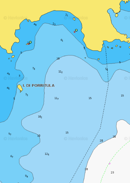
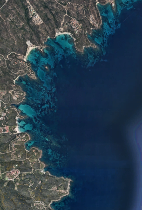
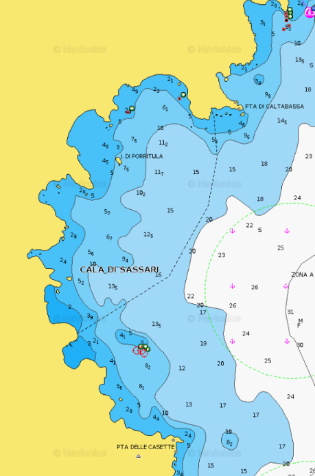
OLBIA AREA - Cala Sassari
×
OLBIA AREA - Cala Sassari
Cala Sassari is located before the town of Golfo Aranci. This large creek is characterized by crystal clear water, white sand and some granitic rocks. The beach is also bordered by two promontories that protect the cove from Mistral wind. The shallowness of the water let children swim and play without dangers.GENERAL RESTRICTIONS:- Navigation within 200 m from the coast
- Anchoring within 200 m from the coast
- 10 knots speed limit within 1 km from the coast
- Running any craft within 200 m from the coast with engines on
- Tying lines to rocks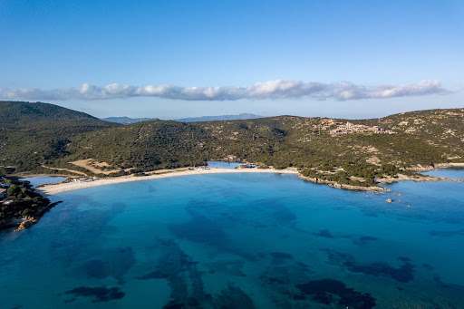
ANCHORAGE NAME OLBIA AREA - CALA SASSARI COORDINATES 40°59'10.63"N 9°35'18.00"E HIGHLIGHTS NATURAL BEAUTY SHELTERED FROM NW - W WINDS LIMITS AND PROHIBITIONS NO FURTHER RESTRICTIONS SEABOTTOM SAND, ROCKS FACILITIES TO LAND ASHORE NONE FACILITIES ASHORE YES CLOSER DROP OFF POINT GOLFO ARANCI TOURISTIC PORT NEAREST COASTGUARD STATION GOLFO ARANCI -
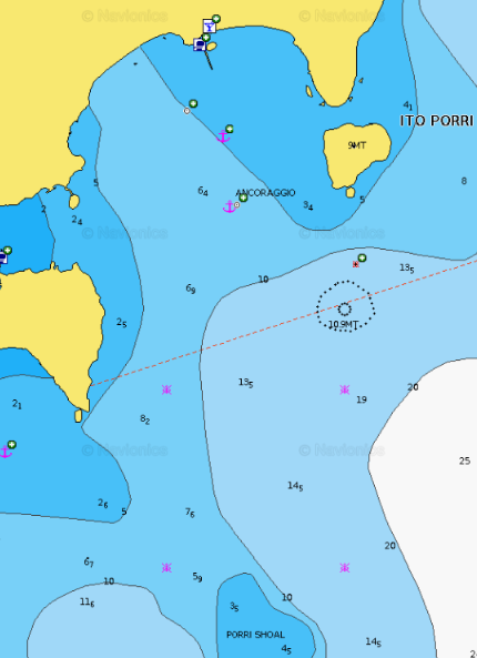
OLBIA AREA - Nodu Pianu/Cala Banana
×
OLBIA AREA - Nodu Pianu/Cala Banana
a small, well-sheltered cove, with Porri Island providing protection to the east, making it an ideal anchorage. Cala Banana, situated within the Cala Banana and Nodu Pianu resort area, boasts the view of Porri Island on its left. The beach at Cala Banana is distinguished from Nodu Pianu beach by a series of rocks.GENERAL RESTRICTIONS:
- Navigation within 200 m from the coast
- Anchoring within 200 m from the coast
- 10 knots speed limit within 1 km from the coast
- Running any craft within 200 m from the coast with engines on
- Tying lines to rocks
VIEW MAPS ON: NAVIONICS.COM -GOOGLE EARTH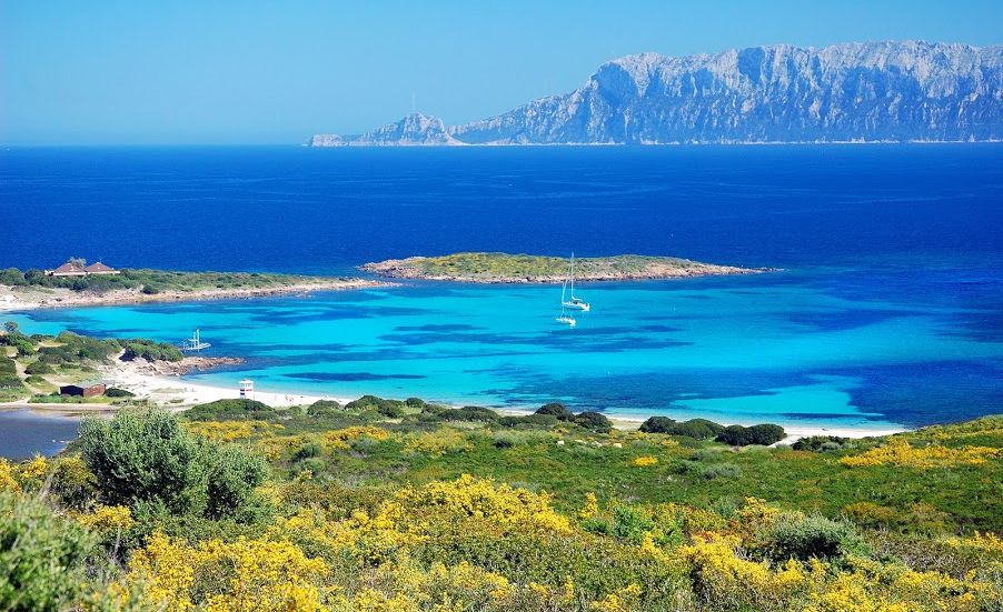
ANCHORAGE NAME OLBIA AREA - NODU PIANU/CALA BANANA COORDINATES 40°57.4671N9°35.1128E HIGHLIGHTS NATURAL BEAUTY SHELTERED FROM NW WIND LIMITS AND PROHIBITIONS NO FURTHER RESTRICTIONS SEABOTTOM SAND FACILITIES TO LAND ASHORE YES FACILITIES ASHORE YES CLOSER DROP OFF POINT GOLFO ARANCI TOURISTIC PORT NEAREST COASTGUARD STATION OLBIA -
OLBIA AREA - Capo Ceraso
×
OLBIA AREA - Capo Ceraso
Point S of Olbia gulf, is the NE end of a promontory. A tower is located on the cape. A shoal extends beyond the cap and extends more than 0.4 NM E of it. A large rock is 0.2 NM E Cape and is indicated by a beacon. An island located 0.1 NM NW of the cape is also marked by a beacon. This cape is the N limit of Natural Area marina protetta Tavolara - Punta Coda Cavallo.GENERAL RESTRICTIONS:
- Navigation within 200 m from the coast
- Anchoring within 200 m from the coast
- 10 knots speed limit within 1 km from the coast
- Running any craft within 200 m from the coast with engines on
- Tying lines to rocks
VIEW MAPS ON: NAVIONICS.COM - GOOGLE EARTH
ANCHORAGE NAME CAPO CERASO COORDINATES 40°55'14.8"N 9°38'54.0"E HIGHLIGHTS NATURAL BEAUTY SHELTERED FROM MISTRAL AND W WIND LIMITS AND PROHIBITIONS CHECK ZONE B AND C RULES OF TAVOLARA PARK ZONING MAP SEABOTTOM SAND FACILITIES TO LAND ASHORE NO FACILITIES ASHORE NO FACILITIES ON THE SHORE CLOSER DROP OFF POINT PORTO SAN PAOLO – FERRY DOCK 40°52'50.0"N 9°38'12.8"E NEAREST COASTGUARD STATION OLBIA -
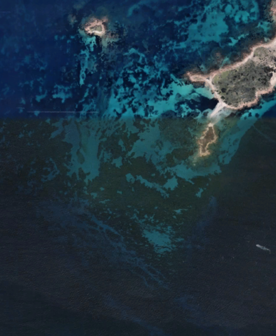
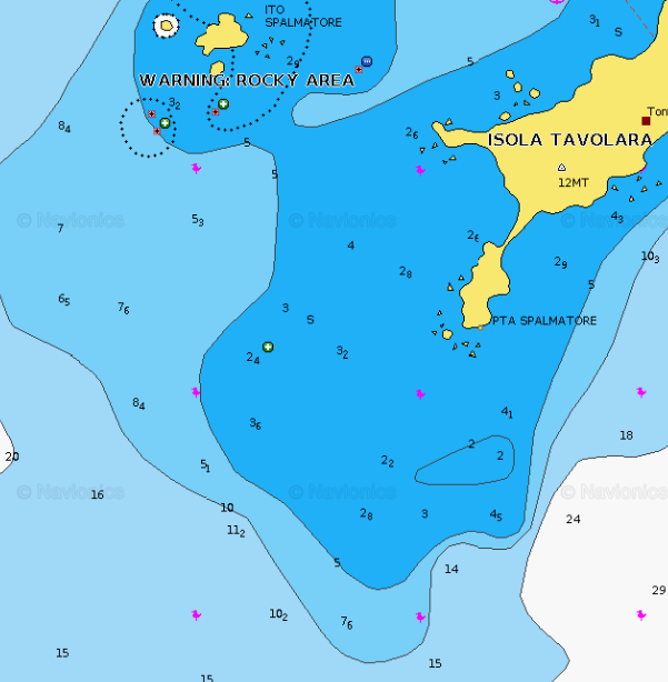
TAVOLARA AREA - Punta Spalmatore
×
TAVOLARA AREA - Punta Spalmatore
Spalmatore di Terra lies on the SW end of Tavolara Island and offers anchorage in a depth of 20m, about midway between the entrance points. Several houses are located at the end of the bay and a conspicuous lime kiln is situated on its E side. A low, narrow, and sandy peninsula extends 0.5 mile SW and forms the NW side. A shoal area extends up to 0.5 mile NW of this sandy peninsula and Isolotto Verde, Isolotto Spalmatore, and numerous rocks lie on it.PARK RESTRICTIONS:
- SEE THE ZONING MAP OF TAVOLARA NATURAL PARKGENERAL RESTRICTIONS:- Navigation within 200 m from the coast
- Anchoring within 200 m from the coast
- 10 knots speed limit within 1 km from the coast
- Running any craft within 200 m from the coast with engines on
- Tying lines to rocks
ANCHORAGE NAME TAVOLARA AREA - PUNTA SPALMATORE COORDINATES 40°53'29.2"N 9°40'57.1"E HIGHLIGHTS NATURAL BEAUTY SHELTERED FROM NW - N - NE - SW - S WINDS LIMITS AND PROHIBITIONS NATURAL PARK REGULATIONS - NO JETSKIS SEABOTTOM SAND FACILITIES TO LAND ASHORE YES FACILITIES ASHORE YES CLOSER DROP OFF POINT PORTO SAN PAOLO FERRY DOCK NEAREST COASTGUARD STATION OLBIA -
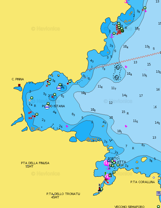
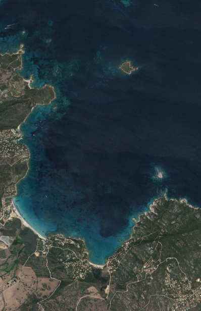
OLBIA AREA - Porto Istana
×
OLBIA AREA - Porto Istana
Opposite the island Tavolara, this bay is bordered by a beautiful white sand beach and is partly sheltered by the island of Tavolara. Day anchorage on sandy bottom (8-4 mt).GENERAL RESTRICTIONS:- Navigation within 200 m from the coast
- Anchoring within 200 m from the coast
- 10 knots speed limit within 1 km from the coast
- Running any craft within 200 m from the coast with engines on
- Tying lines to rocks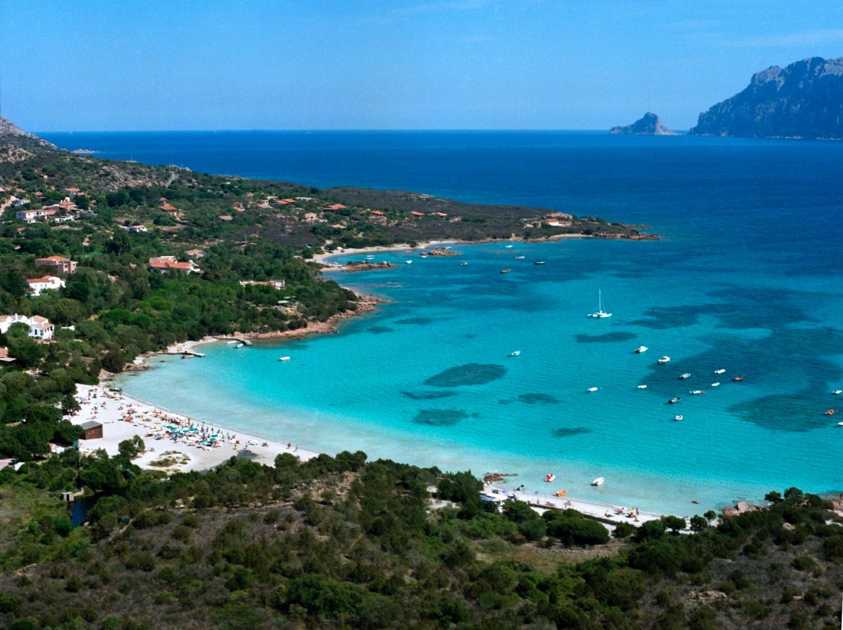
ANCHORAGE NAME OLBIA AREA - PORTO ISTANA COORDINATES 40°53'33.0"N 9°37'21.4"E HIGHLIGHTS NATURAL BEAUTY SHELTERED FROM NW - W WIND LIMITS AND PROHIBITIONS TAVOLARA PARK ZONING MAP (CHECK ZONE B AND C ) SEABOTTOM SAND FACILITIES TO LAND ASHORE NONE FACILITIES ASHORE YES CLOSER DROP OFF POINT PORTO SAN PAOLO FERRY DOCK NEAREST COASTGUARD STATION OLBIA -
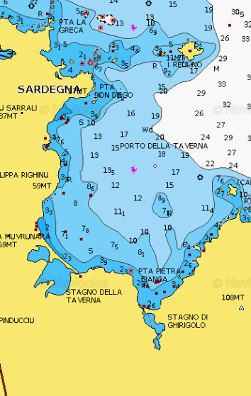
OLBIA AREA - Porto Taverna
×
OLBIA AREA - Porto Taverna
Porto Taverna, holiday village is located south of Olbia, on the east coast of Sardinia. You can anchor for the day (7 to 18 m) on the sandy bottom, the bay is protected in part by the island Tavolara. On the beach there is a coffee bar. Behind the beach there is a lagoon, where it is sometimes possible to observe flamingos.GENERAL RESTRICTIONS:- Navigation within 200 m from the coast
- Anchoring within 200 m from the coast
- 10 knots speed limit within 1 km from the coast
- Running any craft within 200 m from the coast with engines on
- Tying lines to rocks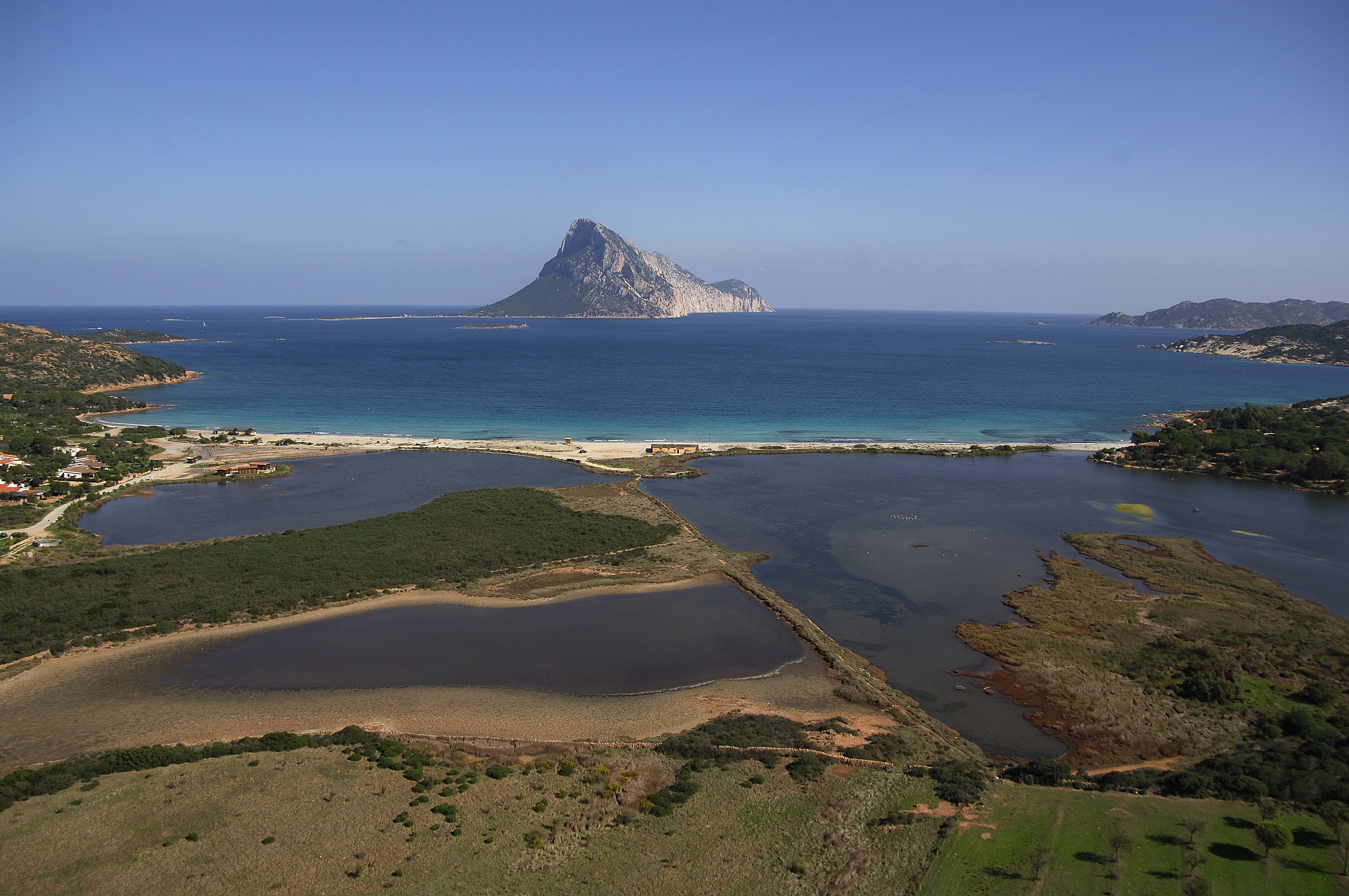
ANCHORAGE NAME OLBIA AREA - PORTO TAVERNA COORDINATES 40°51'38.5"N 9°39'18.9"E HIGHLIGHTS NATURAL BEAUTY SHELTERED FROM NW WIND LIMITS AND PROHIBITIONS NO FURTHER RESTRICTIONS SEABOTTOM SAND FACILITIES TO LAND ASHORE NONE FACILITIES ASHORE YES CLOSER DROP OFF POINT HOTEL DON DIEGO PRIVATE DOCK OR PORTO SAN PAOLO DOCK NEAREST COASTGUARD STATION OLBIA -
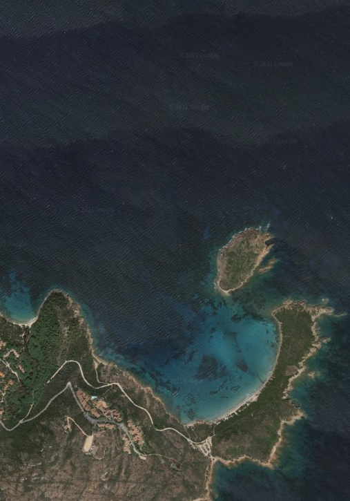
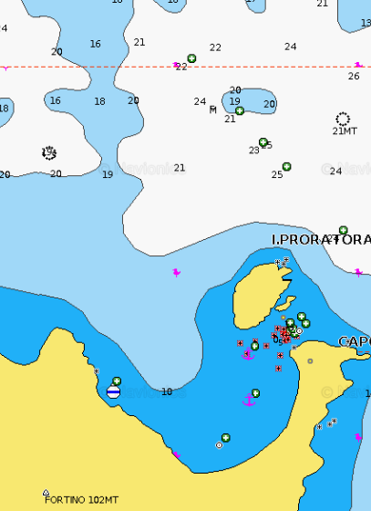
OLBIA AREA - Capo Coda Cavallo
×
OLBIA AREA - Capo Coda Cavallo
This long peninsula beyond the promontory of Monte Petrosu, extending into the Tyrrhenian Sea, has an end portion which is called "Capo Coda Cavallo" ("Queue of horse cape"), because of its curious shape. This is the extreme point of the marine protected area of Tavolara / Coda Cavallo. In front of the tip is Proratora island where you can visit a cave.GENERAL RESTRICTIONS:- Navigation within 200 m from the coast
- Anchoring within 200 m from the coast
- 10 knots speed limit within 1 km from the coast
- Running any craft within 200 m from the coast with engines on
- Tying lines to rocks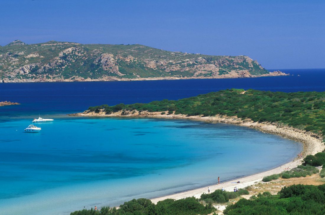
ANCHORAGE NAME OLBIA AREA - CAPO CODA CAVALLO COORDINATES 40°50'36.42"N 9°43'15.43"E HIGHLIGHTS NATURAL BEAUTY SHELTERED FROM NE - SE WINDS LIMITS AND PROHIBITIONS NO FURTHER RESTRICTIONS SEABOTTOM SAND FACILITIES TO LAND ASHORE NONE FACILITIES ASHORE NONE CLOSER DROP OFF POINT HOTEL DON DIEGO PRIVATE DOCK 40°52'07.8"N 9°39'14.0"E OR PORTO SAN PAOLO DOCK NEAREST COASTGUARD STATION OLBIA -
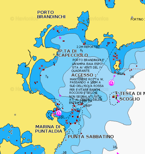
TAVOLARA AREA - Cala Brandinchi
×
TAVOLARA AREA - Cala Brandinchi
Porto Brandinghi or Brandinchi is a large bay that offers a good anchorage, however, discouraged by E wind raises a big swell. Access to the anchorage by about 8 m, passing between Rossa island (S) and Testa di Moro Rock, triangular and inconspicuous, 0.4 M in S.
PARK RESTRICTIONS:
- SEE THE ZONING MAP OF TAVOLARA NATURAL PARKGENERAL RESTRICTIONS:- Navigation within 200 m from the coast
- Anchoring within 200 m from the coast
- 10 knots speed limit within 1 km from the coast
- Running any craft within 200 m from the coast with engines on
- Tying lines to rocks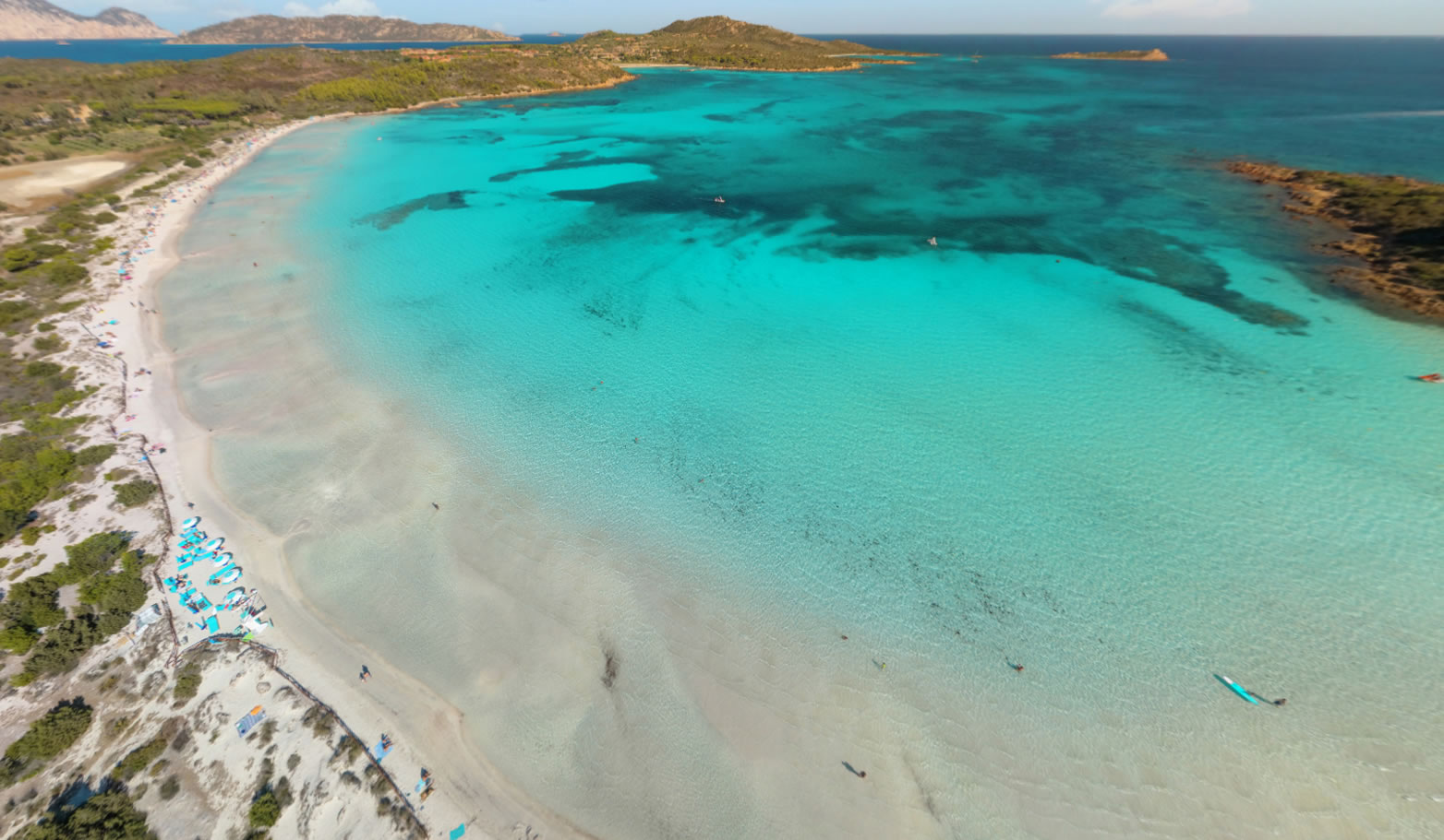
ANCHORAGE NAME TAVOLARA AREA - CALA BRANDINCHI COORDINATES 40°49'44.4"N9°41'27.4"E HIGHLIGHTS NATURAL BEAUTY SHELTERED FROM NW-N-SW WINDS LIMITS AND PROHIBITIONS NO JET SKIS ALLOWED, MARINE PARK RULES SEABOTTOM SAND, ROCKS, SEAWEED FACILITIES TO LAND ASHORE YES FACILITIES ASHORE YES CLOSER DROP OFF POINT MARINA DI PUNTALDIA NEAREST COASTGUARD STATION OLBIA